WRAB Tennant Creek, NT, Australia - Earthquake Result Viewer
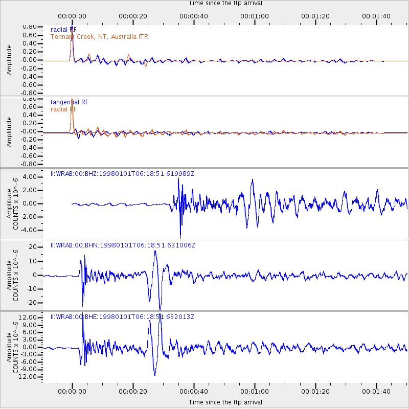
Earthquake location: Volcano Islands, Japan Region
Earthquake latitude/longitude: 23.9/141.9
Earthquake time(UTC): 1998/01/01 (001) 06:11:22 GMT
Earthquake Depth: 96 km
Earthquake Magnitude: 6.4 MB, 5.8 MS, 6.8 UNKNOWN, 6.4 MW
Earthquake Catalog/Contributor: WHDF/NEIC
Network: II Global Seismograph Network (GSN - IRIS/IDA)
Station: WRAB Tennant Creek, NT, Australia
Lat/Lon: 19.93 S/134.36 E
Elevation: 366 m
Distance: 44.2 deg
Az: 190.21 deg
Baz: 9.928 deg
Ray Param: 0.07174988
Estimated Moho Depth: 40.25 km
Estimated Crust Vp/Vs: 1.81
Assumed Crust Vp: 6.642 km/s
Estimated Crust Vs: 3.665 km/s
Estimated Crust Poisson's Ratio: 0.28
Radial Match: 98.74966 %
Radial Bump: 302
Transverse Match: 94.980484 %
Transverse Bump: 400
SOD ConfigId: 4480
Insert Time: 2010-03-01 23:08:51.260 +0000
GWidth: 2.5
Max Bumps: 400
Tol: 0.001

Signal To Noise

ChannelStoNSTALTA
II:WRAB:00:BHN:19980101T06:18:51.631006Z31.4666256.1937876E-61.9683672E-7
II:WRAB:00:BHE:19980101T06:18:51.632013Z18.9106733.6165277E-61.9124266E-7
II:WRAB:00:BHZ:19980101T06:18:51.619989Z4.3795264.971875E-71.1352542E-7
Arrivals
Ps5.3 SECOND
PpPs16 SECOND
PsPs/PpSs21 SECOND