You are here: Home > Network List > TA - USArray Transportable Network (new EarthScope stations) Stations List
> Station R53A Hurricane, WV, USA > Earthquake Result Viewer
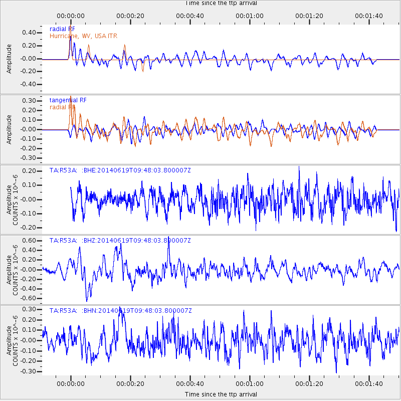
R53A Hurricane, WV, USA - Earthquake Result Viewer
*The percent match for this event was below the threshold and hence no stack was calculated.
| Earthquake location: |
Near Coast Of Northern Chile |
| Earthquake latitude/longitude: |
-20.0/-70.9 |
| Earthquake time(UTC): |
2014/06/19 (170) 09:38:37 GMT |
| Earthquake Depth: |
19 km |
| Earthquake Magnitude: |
5.7 MWP |
| Earthquake Catalog/Contributor: |
NEIC PDE/NEIC COMCAT |
|
| Network: |
TA USArray Transportable Network (new EarthScope stations) |
| Station: |
R53A Hurricane, WV, USA |
| Lat/Lon: |
38.33 N/81.95 W |
| Elevation: |
294 m |
|
| Distance: |
58.9 deg |
| Az: |
349.896 deg |
| Baz: |
167.887 deg |
| Ray Param: |
$rayparam |
*The percent match for this event was below the threshold and hence was not used in the summary stack. |
|
| Radial Match: |
75.95362 % |
| Radial Bump: |
400 |
| Transverse Match: |
66.26419 % |
| Transverse Bump: |
400 |
| SOD ConfigId: |
739768 |
| Insert Time: |
2014-07-03 10:17:58.905 +0000 |
| GWidth: |
2.5 |
| Max Bumps: |
400 |
| Tol: |
0.001 |
|
Signal To Noise
| Channel | StoN | STA | LTA |
| TA:R53A: :BHZ:20140619T09:48:03.800007Z | 3.07695 | 2.1005403E-7 | 6.8266964E-8 |
| TA:R53A: :BHN:20140619T09:48:03.800007Z | 1.4809643 | 8.2777795E-8 | 5.589452E-8 |
| TA:R53A: :BHE:20140619T09:48:03.800007Z | 1.3269805 | 6.643112E-8 | 5.0061868E-8 |
| Arrivals |
| Ps | |
| PpPs | |
| PsPs/PpSs | |


