You are here: Home > Network List > TA - USArray Transportable Network (new EarthScope stations) Stations List
> Station T54A Tazewell, VA, USA > Earthquake Result Viewer
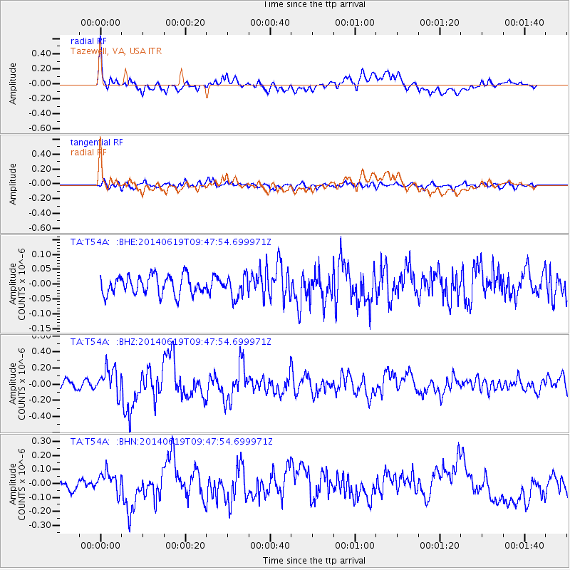
T54A Tazewell, VA, USA - Earthquake Result Viewer
*The percent match for this event was below the threshold and hence no stack was calculated.
| Earthquake location: |
Near Coast Of Northern Chile |
| Earthquake latitude/longitude: |
-20.0/-70.9 |
| Earthquake time(UTC): |
2014/06/19 (170) 09:38:37 GMT |
| Earthquake Depth: |
19 km |
| Earthquake Magnitude: |
5.7 MWP |
| Earthquake Catalog/Contributor: |
NEIC PDE/NEIC COMCAT |
|
| Network: |
TA USArray Transportable Network (new EarthScope stations) |
| Station: |
T54A Tazewell, VA, USA |
| Lat/Lon: |
37.06 N/81.58 W |
| Elevation: |
852 m |
|
| Distance: |
57.6 deg |
| Az: |
349.928 deg |
| Baz: |
168.133 deg |
| Ray Param: |
$rayparam |
*The percent match for this event was below the threshold and hence was not used in the summary stack. |
|
| Radial Match: |
74.233 % |
| Radial Bump: |
400 |
| Transverse Match: |
64.33566 % |
| Transverse Bump: |
400 |
| SOD ConfigId: |
739768 |
| Insert Time: |
2014-07-03 10:19:13.867 +0000 |
| GWidth: |
2.5 |
| Max Bumps: |
400 |
| Tol: |
0.001 |
|
Signal To Noise
| Channel | StoN | STA | LTA |
| TA:T54A: :BHZ:20140619T09:47:54.699971Z | 3.0885487 | 1.6724415E-7 | 5.414976E-8 |
| TA:T54A: :BHN:20140619T09:47:54.699971Z | 1.49441 | 7.3967136E-8 | 4.9495878E-8 |
| TA:T54A: :BHE:20140619T09:47:54.699971Z | 1.1682003 | 3.638717E-8 | 3.114806E-8 |
| Arrivals |
| Ps | |
| PpPs | |
| PsPs/PpSs | |


