
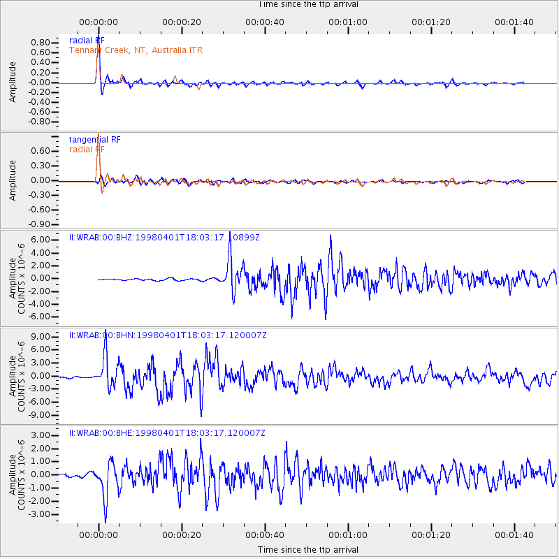
WRAB Tennant Creek, NT, Australia - Earthquake Result Viewer
| ||||||||||||||||||
| ||||||||||||||||||
| ||||||||||||||||||
|
Signal To Noise
| Channel | StoN | STA | LTA |
| II:WRAB:00:BHN:19980401T18:03:17.120007Z | 26.204617 | 3.731079E-6 | 1.423825E-7 |
| II:WRAB:00:BHE:19980401T18:03:17.120007Z | 13.183887 | 1.3268617E-6 | 1.0064269E-7 |
| II:WRAB:00:BHZ:19980401T18:03:17.10899Z | 19.803637 | 2.5766547E-6 | 1.3011018E-7 |
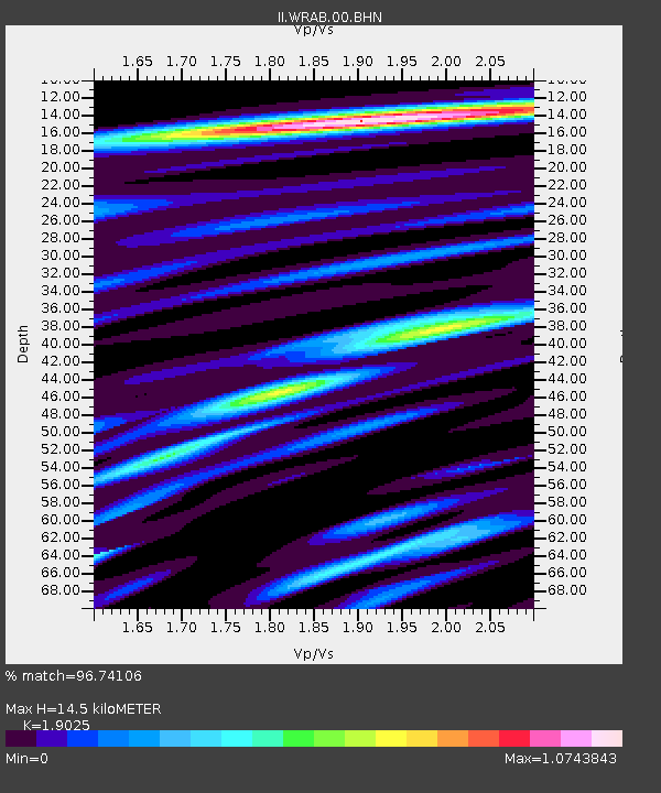
| Arrivals | |
| Ps | 2.1 SECOND |
| PpPs | 5.9 SECOND |
| PsPs/PpSs | 8.0 SECOND |

