You are here: Home > Network List > PF - Volcanologic Network of Piton de Fournaise-OVPF Stations List
> Station HIM cratere Himiltrude > Earthquake Result Viewer
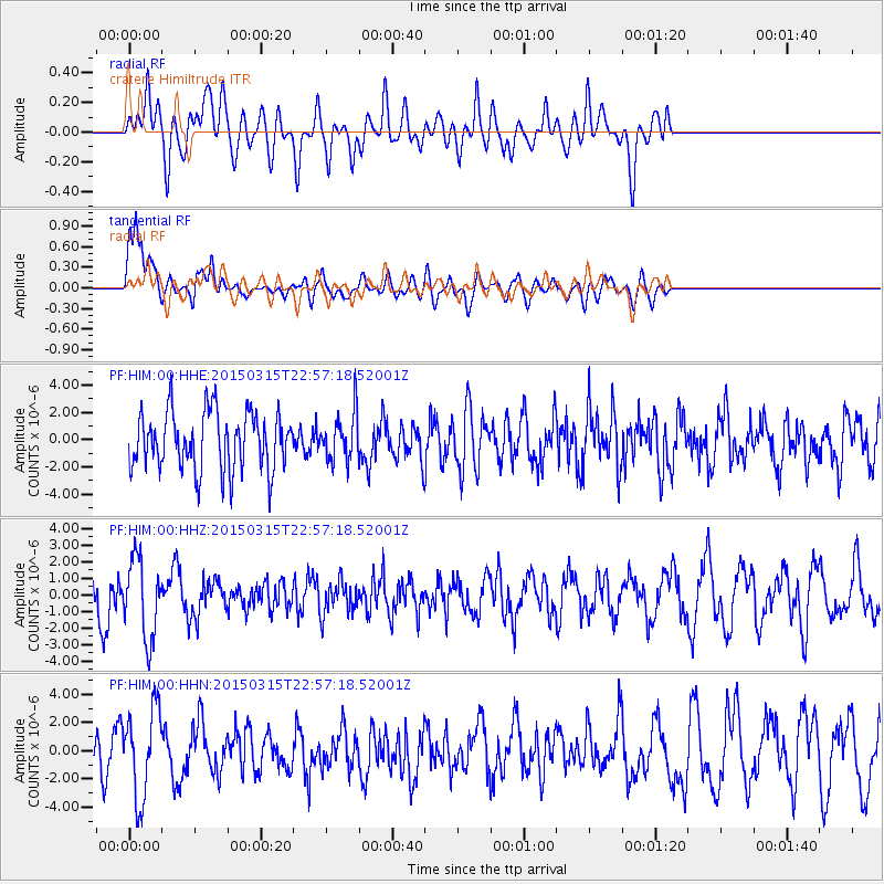
HIM cratere Himiltrude - Earthquake Result Viewer
*The percent match for this event was below the threshold and hence no stack was calculated.
| Earthquake location: |
Southern Mid-Atlantic Ridge |
| Earthquake latitude/longitude: |
-26.1/-11.5 |
| Earthquake time(UTC): |
2015/03/15 (074) 22:47:35 GMT |
| Earthquake Depth: |
10 km |
| Earthquake Magnitude: |
5.0 MW |
| Earthquake Catalog/Contributor: |
ISC/ISC |
|
| Network: |
PF Volcanologic Network of Piton de Fournaise-OVPF |
| Station: |
HIM cratere Himiltrude |
| Lat/Lon: |
21.21 S/55.72 E |
| Elevation: |
1958 m |
|
| Distance: |
61.2 deg |
| Az: |
100.894 deg |
| Baz: |
251.182 deg |
| Ray Param: |
$rayparam |
*The percent match for this event was below the threshold and hence was not used in the summary stack. |
|
| Radial Match: |
48.56217 % |
| Radial Bump: |
400 |
| Transverse Match: |
68.1834 % |
| Transverse Bump: |
400 |
| SOD ConfigId: |
7422571 |
| Insert Time: |
2019-04-17 19:07:30.045 +0000 |
| GWidth: |
2.5 |
| Max Bumps: |
400 |
| Tol: |
0.001 |
|
Signal To Noise
| Channel | StoN | STA | LTA |
| PF:HIM:00:HHZ:20150315T22:57:18.52001Z | 2.361619 | 2.3813302E-6 | 1.0083464E-6 |
| PF:HIM:00:HHN:20150315T22:57:18.52001Z | 2.2363906 | 3.1572517E-6 | 1.4117622E-6 |
| PF:HIM:00:HHE:20150315T22:57:18.52001Z | 0.8150679 | 1.7193152E-6 | 2.1094136E-6 |
| Arrivals |
| Ps | |
| PpPs | |
| PsPs/PpSs | |


