You are here: Home > Network List > TA - USArray Transportable Network (new EarthScope stations) Stations List
> Station G65A Princeton, ME, USA > Earthquake Result Viewer
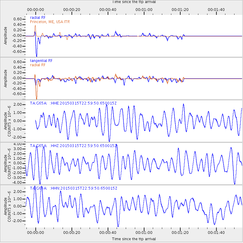
G65A Princeton, ME, USA - Earthquake Result Viewer
*The percent match for this event was below the threshold and hence no stack was calculated.
| Earthquake location: |
Southern Mid-Atlantic Ridge |
| Earthquake latitude/longitude: |
-26.1/-11.5 |
| Earthquake time(UTC): |
2015/03/15 (074) 22:47:35 GMT |
| Earthquake Depth: |
10 km |
| Earthquake Magnitude: |
5.0 MW |
| Earthquake Catalog/Contributor: |
ISC/ISC |
|
| Network: |
TA USArray Transportable Network (new EarthScope stations) |
| Station: |
G65A Princeton, ME, USA |
| Lat/Lon: |
45.20 N/67.56 W |
| Elevation: |
78 m |
|
| Distance: |
87.4 deg |
| Az: |
324.04 deg |
| Baz: |
131.668 deg |
| Ray Param: |
$rayparam |
*The percent match for this event was below the threshold and hence was not used in the summary stack. |
|
| Radial Match: |
83.34375 % |
| Radial Bump: |
400 |
| Transverse Match: |
40.33518 % |
| Transverse Bump: |
400 |
| SOD ConfigId: |
7422571 |
| Insert Time: |
2019-04-17 19:08:01.440 +0000 |
| GWidth: |
2.5 |
| Max Bumps: |
400 |
| Tol: |
0.001 |
|
Signal To Noise
| Channel | StoN | STA | LTA |
| TA:G65A: :HHZ:20150315T22:59:50.650015Z | 2.7867382 | 2.7742165E-6 | 9.955066E-7 |
| TA:G65A: :HHN:20150315T22:59:50.650015Z | 2.9441745 | 1.9257507E-6 | 6.5408847E-7 |
| TA:G65A: :HHE:20150315T22:59:50.650015Z | 0.5342925 | 4.51548E-7 | 8.4513255E-7 |
| Arrivals |
| Ps | |
| PpPs | |
| PsPs/PpSs | |


