You are here: Home > Network List > TA - USArray Transportable Network (new EarthScope stations) Stations List
> Station J61A Chester, VT, USA > Earthquake Result Viewer
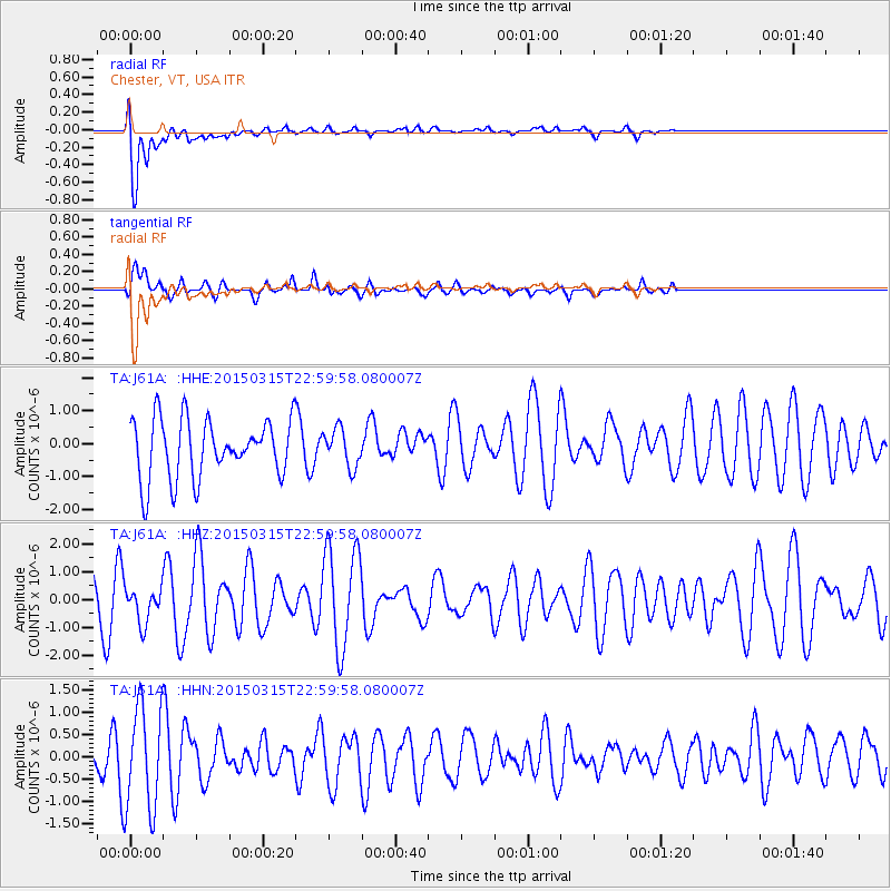
J61A Chester, VT, USA - Earthquake Result Viewer
*The percent match for this event was below the threshold and hence no stack was calculated.
| Earthquake location: |
Southern Mid-Atlantic Ridge |
| Earthquake latitude/longitude: |
-26.1/-11.5 |
| Earthquake time(UTC): |
2015/03/15 (074) 22:47:35 GMT |
| Earthquake Depth: |
10 km |
| Earthquake Magnitude: |
5.0 MW |
| Earthquake Catalog/Contributor: |
ISC/ISC |
|
| Network: |
TA USArray Transportable Network (new EarthScope stations) |
| Station: |
J61A Chester, VT, USA |
| Lat/Lon: |
43.35 N/72.55 W |
| Elevation: |
253 m |
|
| Distance: |
88.9 deg |
| Az: |
320.319 deg |
| Baz: |
128.075 deg |
| Ray Param: |
$rayparam |
*The percent match for this event was below the threshold and hence was not used in the summary stack. |
|
| Radial Match: |
84.825645 % |
| Radial Bump: |
400 |
| Transverse Match: |
69.27726 % |
| Transverse Bump: |
400 |
| SOD ConfigId: |
7422571 |
| Insert Time: |
2019-04-17 19:08:06.216 +0000 |
| GWidth: |
2.5 |
| Max Bumps: |
400 |
| Tol: |
0.001 |
|
Signal To Noise
| Channel | StoN | STA | LTA |
| TA:J61A: :HHZ:20150315T22:59:58.080007Z | 0.5236553 | 6.380282E-7 | 1.2184125E-6 |
| TA:J61A: :HHN:20150315T22:59:58.080007Z | 2.6945136 | 1.1696667E-6 | 4.3409196E-7 |
| TA:J61A: :HHE:20150315T22:59:58.080007Z | 0.638242 | 5.7102704E-7 | 8.9468733E-7 |
| Arrivals |
| Ps | |
| PpPs | |
| PsPs/PpSs | |


