You are here: Home > Network List > TA - USArray Transportable Network (new EarthScope stations) Stations List
> Station O56A Blue Knob State Park, Imler, PA, USA > Earthquake Result Viewer
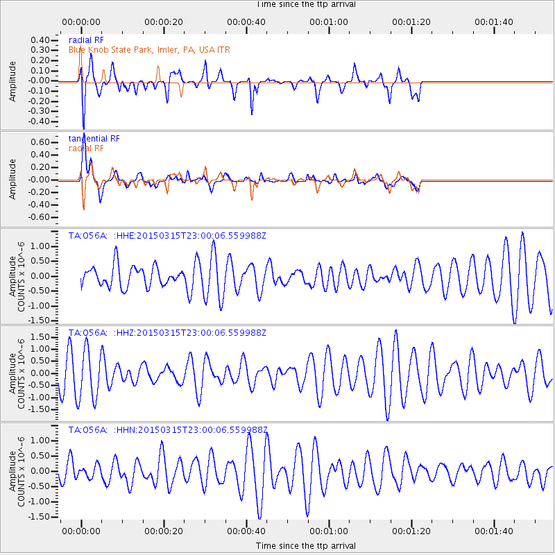
O56A Blue Knob State Park, Imler, PA, USA - Earthquake Result Viewer
*The percent match for this event was below the threshold and hence no stack was calculated.
| Earthquake location: |
Southern Mid-Atlantic Ridge |
| Earthquake latitude/longitude: |
-26.1/-11.5 |
| Earthquake time(UTC): |
2015/03/15 (074) 22:47:35 GMT |
| Earthquake Depth: |
10 km |
| Earthquake Magnitude: |
5.0 MW |
| Earthquake Catalog/Contributor: |
ISC/ISC |
|
| Network: |
TA USArray Transportable Network (new EarthScope stations) |
| Station: |
O56A Blue Knob State Park, Imler, PA, USA |
| Lat/Lon: |
40.27 N/78.57 W |
| Elevation: |
684 m |
|
| Distance: |
90.8 deg |
| Az: |
315.19 deg |
| Baz: |
124.064 deg |
| Ray Param: |
$rayparam |
*The percent match for this event was below the threshold and hence was not used in the summary stack. |
|
| Radial Match: |
72.82231 % |
| Radial Bump: |
400 |
| Transverse Match: |
66.7623 % |
| Transverse Bump: |
400 |
| SOD ConfigId: |
7422571 |
| Insert Time: |
2019-04-17 19:08:16.743 +0000 |
| GWidth: |
2.5 |
| Max Bumps: |
400 |
| Tol: |
0.001 |
|
Signal To Noise
| Channel | StoN | STA | LTA |
| TA:O56A: :HHZ:20150315T23:00:06.559988Z | 4.2746215 | 1.0339834E-6 | 2.4188887E-7 |
| TA:O56A: :HHN:20150315T23:00:06.559988Z | 0.57812375 | 1.9462362E-7 | 3.36647E-7 |
| TA:O56A: :HHE:20150315T23:00:06.559988Z | 2.3387434 | 7.63848E-7 | 3.2660614E-7 |
| Arrivals |
| Ps | |
| PpPs | |
| PsPs/PpSs | |


