You are here: Home > Network List > TA - USArray Transportable Network (new EarthScope stations) Stations List
> Station Z41A Richland Creek Farm, El Dorado, AR, USA > Earthquake Result Viewer
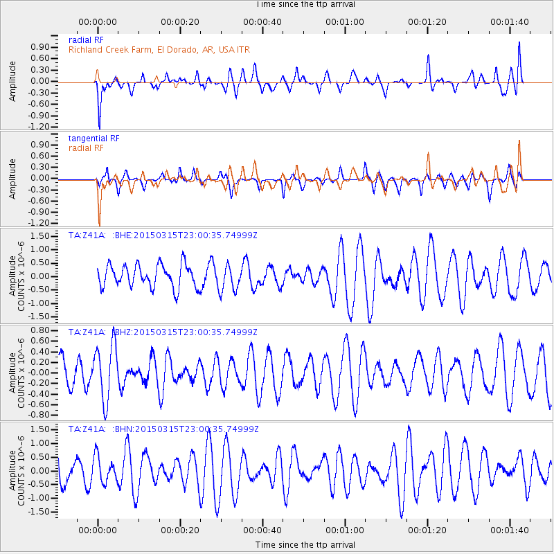
Z41A Richland Creek Farm, El Dorado, AR, USA - Earthquake Result Viewer
*The percent match for this event was below the threshold and hence no stack was calculated.
| Earthquake location: |
Southern Mid-Atlantic Ridge |
| Earthquake latitude/longitude: |
-26.1/-11.5 |
| Earthquake time(UTC): |
2015/03/15 (074) 22:47:35 GMT |
| Earthquake Depth: |
10 km |
| Earthquake Magnitude: |
5.0 MW |
| Earthquake Catalog/Contributor: |
ISC/ISC |
|
| Network: |
TA USArray Transportable Network (new EarthScope stations) |
| Station: |
Z41A Richland Creek Farm, El Dorado, AR, USA |
| Lat/Lon: |
33.26 N/92.80 W |
| Elevation: |
62 m |
|
| Distance: |
97.2 deg |
| Az: |
303.407 deg |
| Baz: |
116.354 deg |
| Ray Param: |
$rayparam |
*The percent match for this event was below the threshold and hence was not used in the summary stack. |
|
| Radial Match: |
43.193287 % |
| Radial Bump: |
400 |
| Transverse Match: |
53.731003 % |
| Transverse Bump: |
400 |
| SOD ConfigId: |
7422571 |
| Insert Time: |
2019-04-17 19:08:29.391 +0000 |
| GWidth: |
2.5 |
| Max Bumps: |
400 |
| Tol: |
0.001 |
|
Signal To Noise
| Channel | StoN | STA | LTA |
| TA:Z41A: :BHZ:20150315T23:00:35.74999Z | 2.7232974 | 5.397334E-7 | 1.9819112E-7 |
| TA:Z41A: :BHN:20150315T23:00:35.74999Z | 1.0368092 | 4.776141E-7 | 4.6065767E-7 |
| TA:Z41A: :BHE:20150315T23:00:35.74999Z | 1.1438985 | 4.750128E-7 | 4.152578E-7 |
| Arrivals |
| Ps | |
| PpPs | |
| PsPs/PpSs | |


