You are here: Home > Network List > UW - Pacific Northwest Regional Seismic Network Stations List
> Station LEBA Lebam, WA, USA > Earthquake Result Viewer
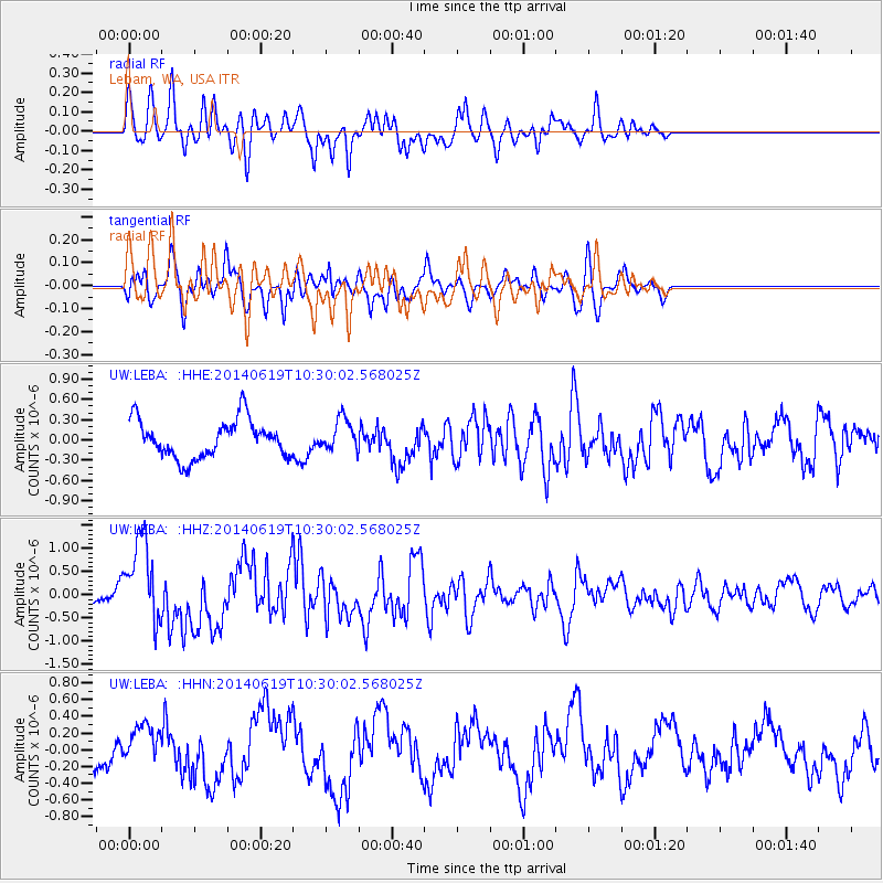
LEBA Lebam, WA, USA - Earthquake Result Viewer
*The percent match for this event was below the threshold and hence no stack was calculated.
| Earthquake location: |
Vanuatu Islands |
| Earthquake latitude/longitude: |
-13.6/166.8 |
| Earthquake time(UTC): |
2014/06/19 (170) 10:17:58 GMT |
| Earthquake Depth: |
60 km |
| Earthquake Magnitude: |
6.4 MWP |
| Earthquake Catalog/Contributor: |
NEIC PDE/NEIC COMCAT |
|
| Network: |
UW Pacific Northwest Regional Seismic Network |
| Station: |
LEBA Lebam, WA, USA |
| Lat/Lon: |
46.55 N/123.56 W |
| Elevation: |
73 m |
|
| Distance: |
86.3 deg |
| Az: |
40.416 deg |
| Baz: |
245.983 deg |
| Ray Param: |
$rayparam |
*The percent match for this event was below the threshold and hence was not used in the summary stack. |
|
| Radial Match: |
73.069855 % |
| Radial Bump: |
400 |
| Transverse Match: |
80.48926 % |
| Transverse Bump: |
400 |
| SOD ConfigId: |
739768 |
| Insert Time: |
2014-07-03 10:56:49.285 +0000 |
| GWidth: |
2.5 |
| Max Bumps: |
400 |
| Tol: |
0.001 |
|
Signal To Noise
| Channel | StoN | STA | LTA |
| UW:LEBA: :HHZ:20140619T10:30:02.568025Z | 3.4595323 | 9.2746785E-7 | 2.6809056E-7 |
| UW:LEBA: :HHN:20140619T10:30:02.568025Z | 1.6692979 | 2.3787707E-7 | 1.4250126E-7 |
| UW:LEBA: :HHE:20140619T10:30:02.568025Z | 0.8367994 | 2.332875E-7 | 2.7878545E-7 |
| Arrivals |
| Ps | |
| PpPs | |
| PsPs/PpSs | |


