
WRAB Tennant Creek, NT, Australia - Earthquake Result Viewer
| ||||||||||||||||||
| ||||||||||||||||||
| ||||||||||||||||||
|
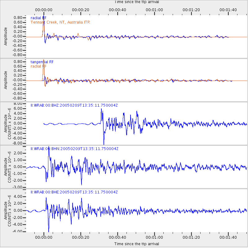
Signal To Noise
| Channel | StoN | STA | LTA |
| II:WRAB:00:BHN:20050209T13:35:11.750004Z | 9.099421 | 1.1599548E-6 | 1.2747567E-7 |
| II:WRAB:00:BHE:20050209T13:35:11.750004Z | 16.953789 | 1.8947215E-6 | 1.11758E-7 |
| II:WRAB:00:BHZ:20050209T13:35:11.750004Z | 18.155827 | 2.9423236E-6 | 1.6205946E-7 |
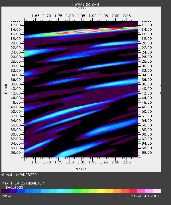
| Arrivals | |
| Ps | 2.0 SECOND |
| PpPs | 5.8 SECOND |
| PsPs/PpSs | 7.9 SECOND |

