
WRAB Tennant Creek, NT, Australia - Earthquake Result Viewer
| ||||||||||||||||||
| ||||||||||||||||||
| ||||||||||||||||||
|
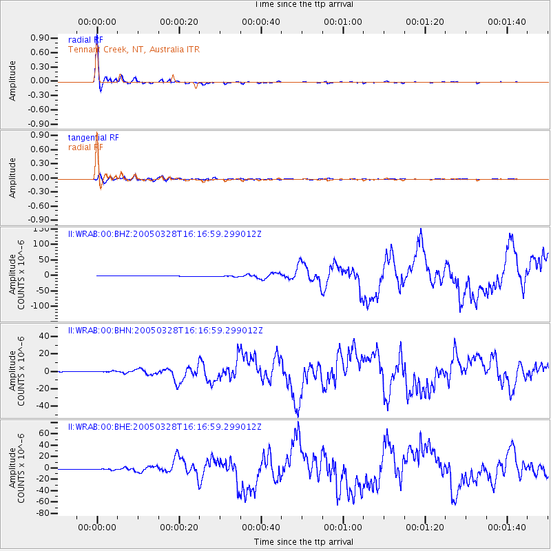
Signal To Noise
| Channel | StoN | STA | LTA |
| II:WRAB:00:BHN:20050328T16:16:59.299012Z | 4.738682 | 8.379235E-7 | 1.7682628E-7 |
| II:WRAB:00:BHE:20050328T16:16:59.299012Z | 4.6177015 | 1.3498507E-6 | 2.923209E-7 |
| II:WRAB:00:BHZ:20050328T16:16:59.299012Z | 4.4189916 | 1.9796546E-6 | 4.479879E-7 |
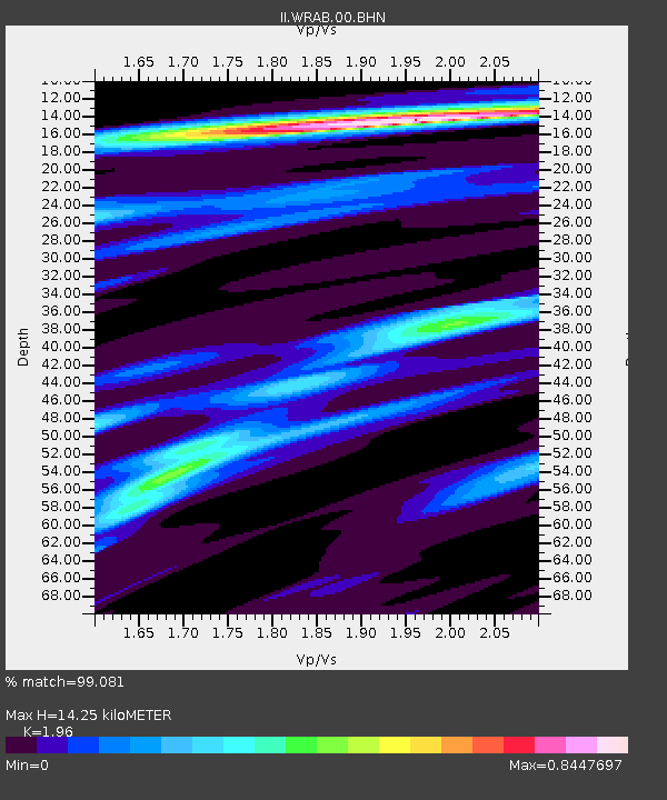
| Arrivals | |
| Ps | 2.2 SECOND |
| PpPs | 6.0 SECOND |
| PsPs/PpSs | 8.1 SECOND |

