You are here: Home > Network List > TA - USArray Transportable Network (new EarthScope stations) Stations List
> Station A21K Barrow, AK, USA > Earthquake Result Viewer
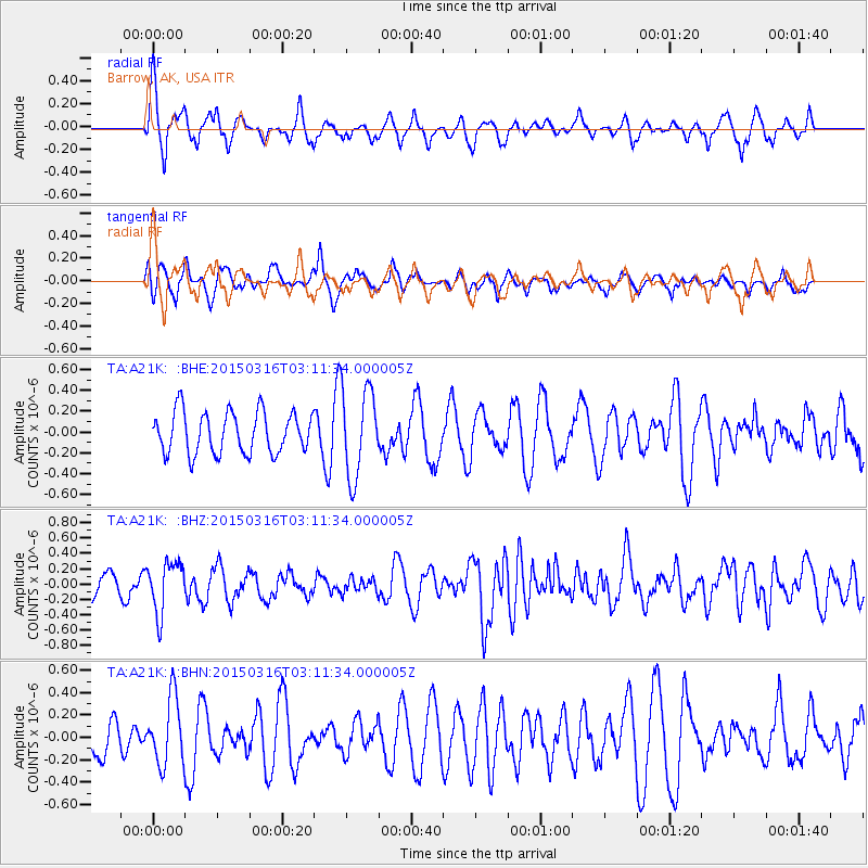
A21K Barrow, AK, USA - Earthquake Result Viewer
*The percent match for this event was below the threshold and hence no stack was calculated.
| Earthquake location: |
New Britain Region, P.N.G. |
| Earthquake latitude/longitude: |
-4.1/152.0 |
| Earthquake time(UTC): |
2015/03/16 (075) 03:00:06 GMT |
| Earthquake Depth: |
199 km |
| Earthquake Magnitude: |
5.9 MWP |
| Earthquake Catalog/Contributor: |
NEIC PDE/NEIC COMCAT |
|
| Network: |
TA USArray Transportable Network (new EarthScope stations) |
| Station: |
A21K Barrow, AK, USA |
| Lat/Lon: |
71.32 N/156.62 W |
| Elevation: |
577 m |
|
| Distance: |
82.3 deg |
| Az: |
14.706 deg |
| Baz: |
231.807 deg |
| Ray Param: |
$rayparam |
*The percent match for this event was below the threshold and hence was not used in the summary stack. |
|
| Radial Match: |
69.627335 % |
| Radial Bump: |
400 |
| Transverse Match: |
48.517265 % |
| Transverse Bump: |
367 |
| SOD ConfigId: |
7422571 |
| Insert Time: |
2019-04-17 19:16:08.764 +0000 |
| GWidth: |
2.5 |
| Max Bumps: |
400 |
| Tol: |
0.001 |
|
Signal To Noise
| Channel | StoN | STA | LTA |
| TA:A21K: :BHZ:20150316T03:11:34.000005Z | 1.8651335 | 3.31171E-7 | 1.7755887E-7 |
| TA:A21K: :BHN:20150316T03:11:34.000005Z | 1.2854885 | 3.005682E-7 | 2.3381631E-7 |
| TA:A21K: :BHE:20150316T03:11:34.000005Z | 1.9513944 | 3.9087914E-7 | 2.003076E-7 |
| Arrivals |
| Ps | |
| PpPs | |
| PsPs/PpSs | |


