
WRAB Tennant Creek, NT, Australia - Earthquake Result Viewer
| ||||||||||||||||||
| ||||||||||||||||||
| ||||||||||||||||||
|
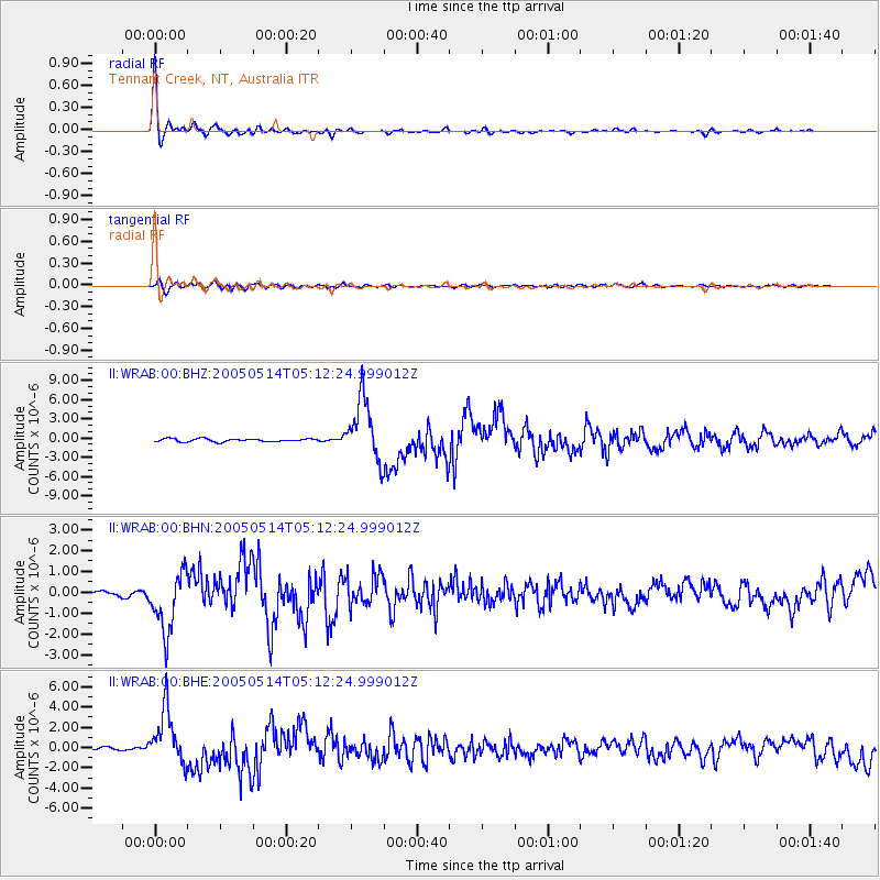
Signal To Noise
| Channel | StoN | STA | LTA |
| II:WRAB:00:BHN:20050514T05:12:24.999012Z | 11.094911 | 1.4214457E-6 | 1.2811692E-7 |
| II:WRAB:00:BHE:20050514T05:12:24.999012Z | 23.064884 | 2.6574792E-6 | 1.1521754E-7 |
| II:WRAB:00:BHZ:20050514T05:12:24.999012Z | 21.086145 | 4.772261E-6 | 2.2632211E-7 |
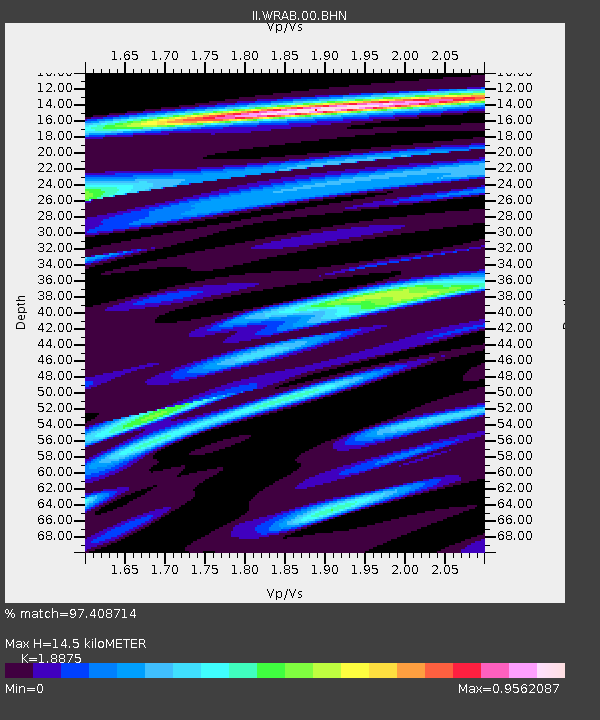
| Arrivals | |
| Ps | 2.1 SECOND |
| PpPs | 5.9 SECOND |
| PsPs/PpSs | 8.0 SECOND |

