
WRAB Tennant Creek, NT, Australia - Earthquake Result Viewer
| ||||||||||||||||||
| ||||||||||||||||||
| ||||||||||||||||||
|
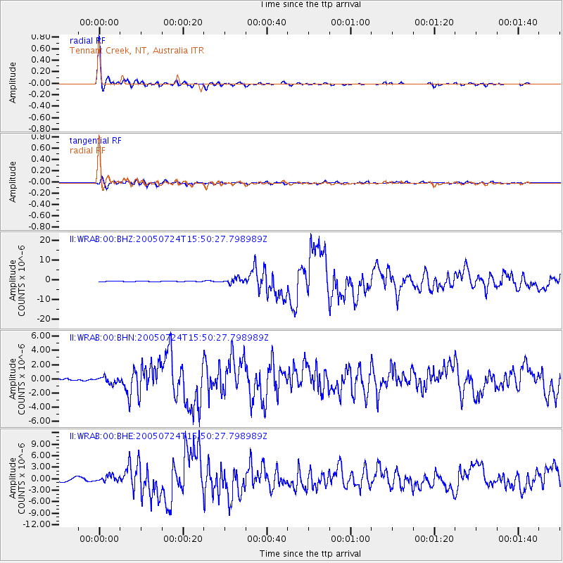
Signal To Noise
| Channel | StoN | STA | LTA |
| II:WRAB:00:BHN:20050724T15:50:27.798989Z | 2.5821028 | 4.6740575E-7 | 1.8101748E-7 |
| II:WRAB:00:BHE:20050724T15:50:27.798989Z | 1.9932492 | 8.046682E-7 | 4.0369676E-7 |
| II:WRAB:00:BHZ:20050724T15:50:27.798989Z | 8.04603 | 1.3403132E-6 | 1.6658069E-7 |
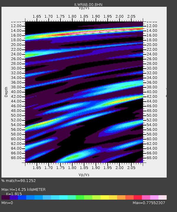
| Arrivals | |
| Ps | 2.1 SECOND |
| PpPs | 5.9 SECOND |
| PsPs/PpSs | 8.0 SECOND |

