You are here: Home > Network List > TA - USArray Transportable Network (new EarthScope stations) Stations List
> Station E62A Clayton Lake, ME, USA > Earthquake Result Viewer
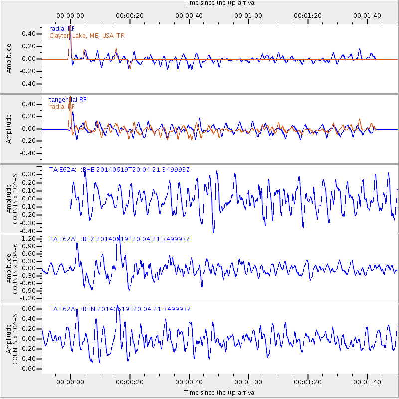
E62A Clayton Lake, ME, USA - Earthquake Result Viewer
*The percent match for this event was below the threshold and hence no stack was calculated.
| Earthquake location: |
Near Coast Of Northern Chile |
| Earthquake latitude/longitude: |
-19.8/-70.8 |
| Earthquake time(UTC): |
2014/06/19 (170) 19:54:05 GMT |
| Earthquake Depth: |
11 km |
| Earthquake Magnitude: |
5.7 MWB |
| Earthquake Catalog/Contributor: |
NEIC PDE/NEIC COMCAT |
|
| Network: |
TA USArray Transportable Network (new EarthScope stations) |
| Station: |
E62A Clayton Lake, ME, USA |
| Lat/Lon: |
46.62 N/69.52 W |
| Elevation: |
356 m |
|
| Distance: |
66.2 deg |
| Az: |
0.985 deg |
| Baz: |
181.345 deg |
| Ray Param: |
$rayparam |
*The percent match for this event was below the threshold and hence was not used in the summary stack. |
|
| Radial Match: |
65.58977 % |
| Radial Bump: |
400 |
| Transverse Match: |
75.068726 % |
| Transverse Bump: |
400 |
| SOD ConfigId: |
739768 |
| Insert Time: |
2014-07-03 20:31:55.488 +0000 |
| GWidth: |
2.5 |
| Max Bumps: |
400 |
| Tol: |
0.001 |
|
Signal To Noise
| Channel | StoN | STA | LTA |
| TA:E62A: :BHZ:20140619T20:04:21.349993Z | 4.0641894 | 4.1896138E-7 | 1.0308609E-7 |
| TA:E62A: :BHN:20140619T20:04:21.349993Z | 2.1063383 | 2.4918253E-7 | 1.1830128E-7 |
| TA:E62A: :BHE:20140619T20:04:21.349993Z | 0.94291157 | 1.2046702E-7 | 1.2776069E-7 |
| Arrivals |
| Ps | |
| PpPs | |
| PsPs/PpSs | |


