You are here: Home > Network List > TA - USArray Transportable Network (new EarthScope stations) Stations List
> Station J61A Chester, VT, USA > Earthquake Result Viewer
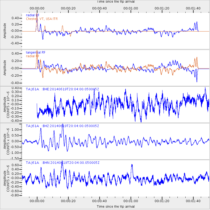
J61A Chester, VT, USA - Earthquake Result Viewer
*The percent match for this event was below the threshold and hence no stack was calculated.
| Earthquake location: |
Near Coast Of Northern Chile |
| Earthquake latitude/longitude: |
-19.8/-70.8 |
| Earthquake time(UTC): |
2014/06/19 (170) 19:54:05 GMT |
| Earthquake Depth: |
11 km |
| Earthquake Magnitude: |
5.7 MWB |
| Earthquake Catalog/Contributor: |
NEIC PDE/NEIC COMCAT |
|
| Network: |
TA USArray Transportable Network (new EarthScope stations) |
| Station: |
J61A Chester, VT, USA |
| Lat/Lon: |
43.35 N/72.55 W |
| Elevation: |
253 m |
|
| Distance: |
62.9 deg |
| Az: |
358.587 deg |
| Baz: |
178.176 deg |
| Ray Param: |
$rayparam |
*The percent match for this event was below the threshold and hence was not used in the summary stack. |
|
| Radial Match: |
55.818504 % |
| Radial Bump: |
400 |
| Transverse Match: |
38.63069 % |
| Transverse Bump: |
400 |
| SOD ConfigId: |
739768 |
| Insert Time: |
2014-07-03 20:37:32.570 +0000 |
| GWidth: |
2.5 |
| Max Bumps: |
400 |
| Tol: |
0.001 |
|
Signal To Noise
| Channel | StoN | STA | LTA |
| TA:J61A: :BHZ:20140619T20:04:00.050005Z | 3.4263363 | 4.4297053E-7 | 1.2928402E-7 |
| TA:J61A: :BHN:20140619T20:04:00.050005Z | 1.3709295 | 1.7341497E-7 | 1.2649446E-7 |
| TA:J61A: :BHE:20140619T20:04:00.050005Z | 1.3574398 | 1.6640728E-7 | 1.2258907E-7 |
| Arrivals |
| Ps | |
| PpPs | |
| PsPs/PpSs | |


