You are here: Home > Network List > CI - Caltech Regional Seismic Network Stations List
> Station TIN Tinemaha, Big Pine, CA, USA > Earthquake Result Viewer
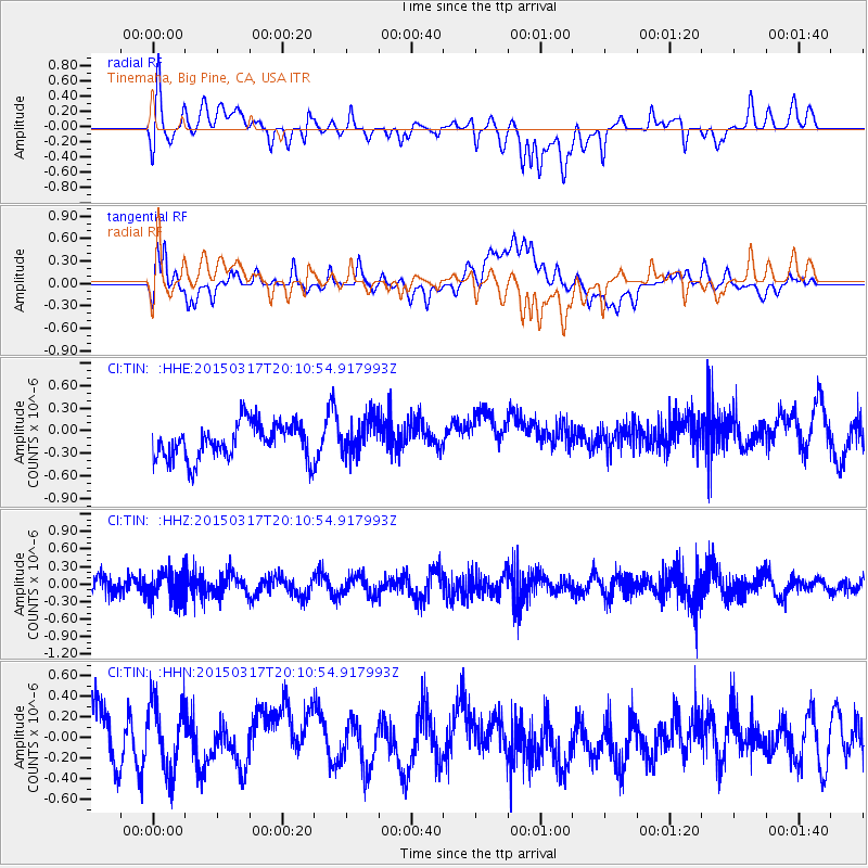
TIN Tinemaha, Big Pine, CA, USA - Earthquake Result Viewer
*The percent match for this event was below the threshold and hence no stack was calculated.
| Earthquake location: |
Kuril Islands |
| Earthquake latitude/longitude: |
43.5/146.2 |
| Earthquake time(UTC): |
2015/03/17 (076) 20:00:27 GMT |
| Earthquake Depth: |
80 km |
| Earthquake Magnitude: |
4.3 mb |
| Earthquake Catalog/Contributor: |
ISC/ISC |
|
| Network: |
CI Caltech Regional Seismic Network |
| Station: |
TIN Tinemaha, Big Pine, CA, USA |
| Lat/Lon: |
37.05 N/118.23 W |
| Elevation: |
1197 m |
|
| Distance: |
69.2 deg |
| Az: |
58.399 deg |
| Baz: |
309.221 deg |
| Ray Param: |
$rayparam |
*The percent match for this event was below the threshold and hence was not used in the summary stack. |
|
| Radial Match: |
47.45013 % |
| Radial Bump: |
400 |
| Transverse Match: |
37.067024 % |
| Transverse Bump: |
400 |
| SOD ConfigId: |
7422571 |
| Insert Time: |
2019-04-17 19:24:05.511 +0000 |
| GWidth: |
2.5 |
| Max Bumps: |
400 |
| Tol: |
0.001 |
|
Signal To Noise
| Channel | StoN | STA | LTA |
| CI:TIN: :HHZ:20150317T20:10:54.917993Z | 1.9145606 | 2.538222E-7 | 1.3257466E-7 |
| CI:TIN: :HHN:20150317T20:10:54.917993Z | 0.98281854 | 3.350766E-7 | 3.4093435E-7 |
| CI:TIN: :HHE:20150317T20:10:54.917993Z | 1.0420619 | 2.4499926E-7 | 2.351101E-7 |
| Arrivals |
| Ps | |
| PpPs | |
| PsPs/PpSs | |


