
WRAB Tennant Creek, NT, Australia - Earthquake Result Viewer
| ||||||||||||||||||
| ||||||||||||||||||
| ||||||||||||||||||
|
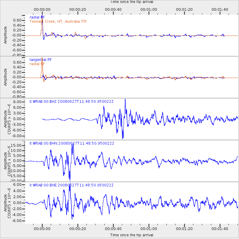
Signal To Noise
| Channel | StoN | STA | LTA |
| II:WRAB:00:BHN:20080627T11:48:50.950022Z | 18.622362 | 4.085947E-6 | 2.1941078E-7 |
| II:WRAB:00:BHE:20080627T11:48:50.950022Z | 5.7820582 | 1.5171905E-6 | 2.6239627E-7 |
| II:WRAB:00:BHZ:20080627T11:48:50.950022Z | 8.205934 | 2.5158424E-6 | 3.065882E-7 |
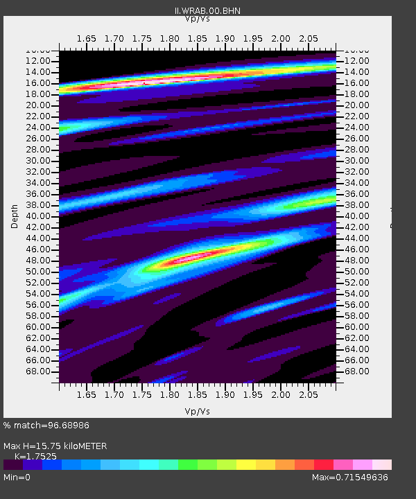
| Arrivals | |
| Ps | 1.9 SECOND |
| PpPs | 6.1 SECOND |
| PsPs/PpSs | 8.0 SECOND |

