You are here: Home > Network List > TA - USArray Transportable Network (new EarthScope stations) Stations List
> Station R11A Troy Canyon, Currant, NV, USA > Earthquake Result Viewer
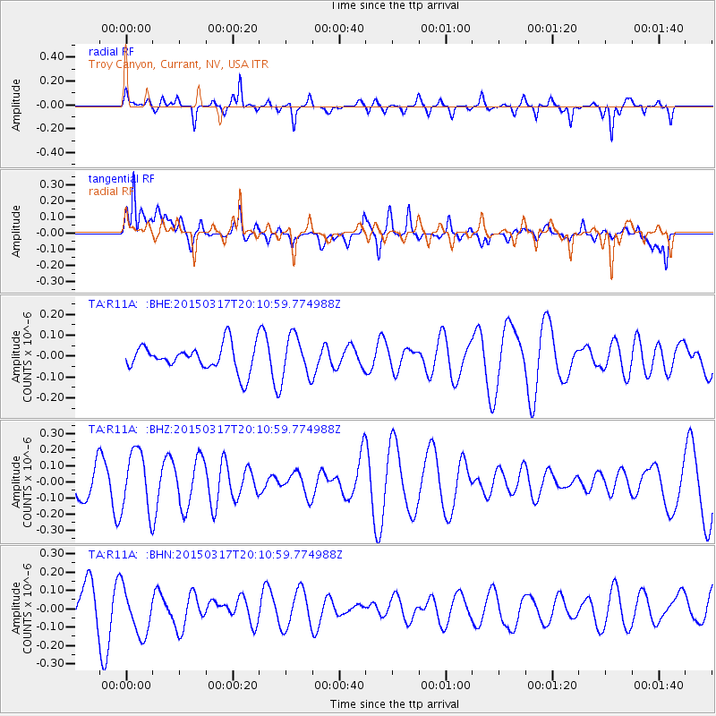
R11A Troy Canyon, Currant, NV, USA - Earthquake Result Viewer
*The percent match for this event was below the threshold and hence no stack was calculated.
| Earthquake location: |
Kuril Islands |
| Earthquake latitude/longitude: |
43.5/146.2 |
| Earthquake time(UTC): |
2015/03/17 (076) 20:00:27 GMT |
| Earthquake Depth: |
80 km |
| Earthquake Magnitude: |
4.3 mb |
| Earthquake Catalog/Contributor: |
ISC/ISC |
|
| Network: |
TA USArray Transportable Network (new EarthScope stations) |
| Station: |
R11A Troy Canyon, Currant, NV, USA |
| Lat/Lon: |
38.35 N/115.59 W |
| Elevation: |
1756 m |
|
| Distance: |
70.0 deg |
| Az: |
55.91 deg |
| Baz: |
309.964 deg |
| Ray Param: |
$rayparam |
*The percent match for this event was below the threshold and hence was not used in the summary stack. |
|
| Radial Match: |
55.793423 % |
| Radial Bump: |
400 |
| Transverse Match: |
70.89621 % |
| Transverse Bump: |
400 |
| SOD ConfigId: |
7422571 |
| Insert Time: |
2019-04-17 19:28:23.373 +0000 |
| GWidth: |
2.5 |
| Max Bumps: |
400 |
| Tol: |
0.001 |
|
Signal To Noise
| Channel | StoN | STA | LTA |
| TA:R11A: :BHZ:20150317T20:10:59.774988Z | 1.5475148 | 1.8666086E-7 | 1.2061976E-7 |
| TA:R11A: :BHN:20150317T20:10:59.774988Z | 1.7145401 | 1.3432953E-7 | 7.834726E-8 |
| TA:R11A: :BHE:20150317T20:10:59.774988Z | 1.5888565 | 9.828557E-8 | 6.185932E-8 |
| Arrivals |
| Ps | |
| PpPs | |
| PsPs/PpSs | |


