You are here: Home > Network List > US - United States National Seismic Network Stations List
> Station MSO Missoula, Montana, USA > Earthquake Result Viewer
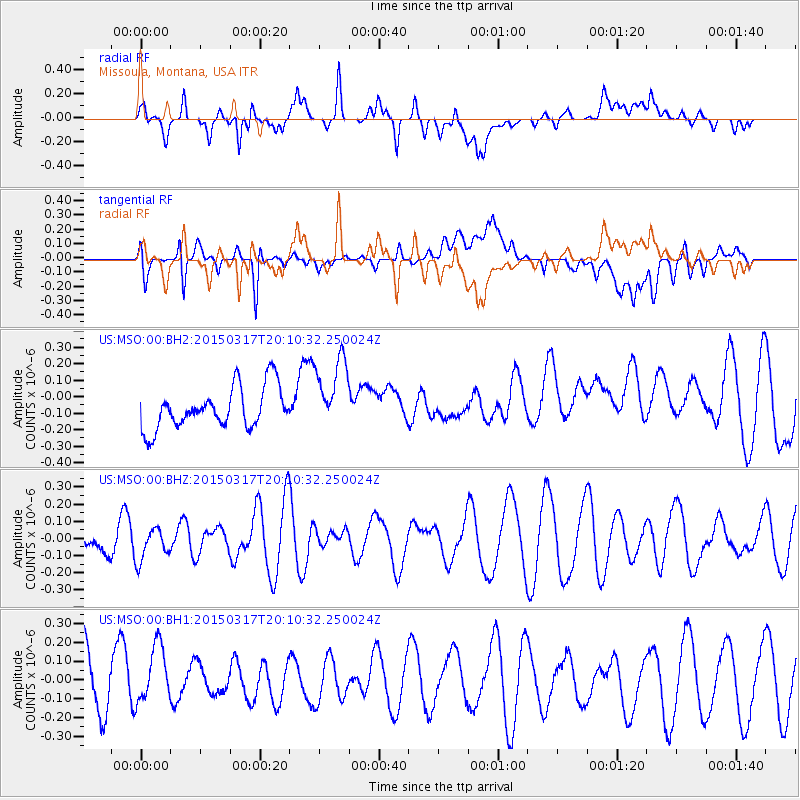
MSO Missoula, Montana, USA - Earthquake Result Viewer
*The percent match for this event was below the threshold and hence no stack was calculated.
| Earthquake location: |
Kuril Islands |
| Earthquake latitude/longitude: |
43.5/146.2 |
| Earthquake time(UTC): |
2015/03/17 (076) 20:00:27 GMT |
| Earthquake Depth: |
80 km |
| Earthquake Magnitude: |
4.3 mb |
| Earthquake Catalog/Contributor: |
ISC/ISC |
|
| Network: |
US United States National Seismic Network |
| Station: |
MSO Missoula, Montana, USA |
| Lat/Lon: |
46.83 N/113.94 W |
| Elevation: |
1264 m |
|
| Distance: |
65.6 deg |
| Az: |
47.973 deg |
| Baz: |
308.071 deg |
| Ray Param: |
$rayparam |
*The percent match for this event was below the threshold and hence was not used in the summary stack. |
|
| Radial Match: |
50.35556 % |
| Radial Bump: |
400 |
| Transverse Match: |
54.382084 % |
| Transverse Bump: |
400 |
| SOD ConfigId: |
7422571 |
| Insert Time: |
2019-04-17 19:29:16.298 +0000 |
| GWidth: |
2.5 |
| Max Bumps: |
400 |
| Tol: |
0.001 |
|
Signal To Noise
| Channel | StoN | STA | LTA |
| US:MSO:00:BHZ:20150317T20:10:32.250024Z | 0.66722876 | 9.493257E-8 | 1.4227889E-7 |
| US:MSO:00:BH1:20150317T20:10:32.250024Z | 1.4862888 | 1.5429724E-7 | 1.0381377E-7 |
| US:MSO:00:BH2:20150317T20:10:32.250024Z | 1.7717315 | 2.2333649E-7 | 1.260555E-7 |
| Arrivals |
| Ps | |
| PpPs | |
| PsPs/PpSs | |


