You are here: Home > Network List > US - United States National Seismic Network Stations List
> Station WMOK Wichita Mountains, Oklahoma, USA > Earthquake Result Viewer
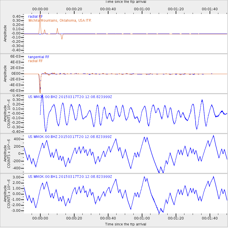
WMOK Wichita Mountains, Oklahoma, USA - Earthquake Result Viewer
*The percent match for this event was below the threshold and hence no stack was calculated.
| Earthquake location: |
Kuril Islands |
| Earthquake latitude/longitude: |
43.5/146.2 |
| Earthquake time(UTC): |
2015/03/17 (076) 20:00:27 GMT |
| Earthquake Depth: |
80 km |
| Earthquake Magnitude: |
4.3 mb |
| Earthquake Catalog/Contributor: |
ISC/ISC |
|
| Network: |
US United States National Seismic Network |
| Station: |
WMOK Wichita Mountains, Oklahoma, USA |
| Lat/Lon: |
34.74 N/98.78 W |
| Elevation: |
486 m |
|
| Distance: |
82.2 deg |
| Az: |
48.872 deg |
| Baz: |
318.276 deg |
| Ray Param: |
$rayparam |
*The percent match for this event was below the threshold and hence was not used in the summary stack. |
|
| Radial Match: |
99.17651 % |
| Radial Bump: |
116 |
| Transverse Match: |
98.89039 % |
| Transverse Bump: |
84 |
| SOD ConfigId: |
7422571 |
| Insert Time: |
2019-04-17 19:29:17.563 +0000 |
| GWidth: |
2.5 |
| Max Bumps: |
400 |
| Tol: |
0.001 |
|
Signal To Noise
| Channel | StoN | STA | LTA |
| US:WMOK:00:BHZ:20150317T20:12:08.823999Z | 1.6614498 | 2.8789163E-4 | 1.7327735E-4 |
| US:WMOK:00:BH1:20150317T20:12:08.823999Z | 1.5527362 | 1.6906835E-6 | 1.0888414E-6 |
| US:WMOK:00:BH2:20150317T20:12:08.823999Z | 0.85916454 | 1.5412658E-7 | 1.7939122E-7 |
| Arrivals |
| Ps | |
| PpPs | |
| PsPs/PpSs | |


