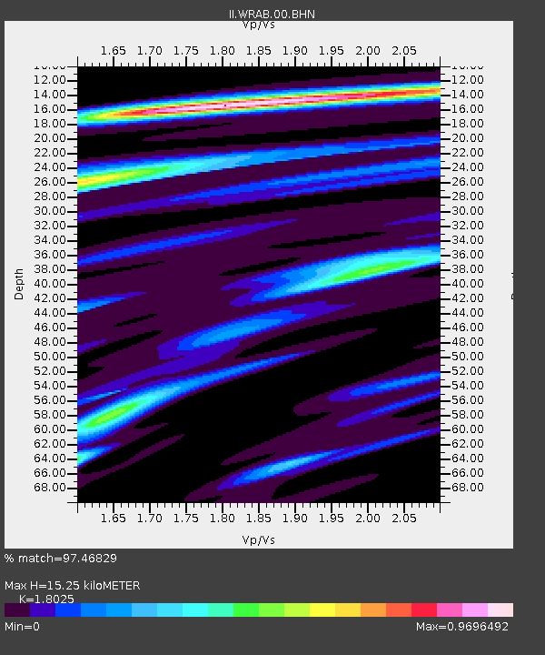
WRAB Tennant Creek, NT, Australia - Earthquake Result Viewer
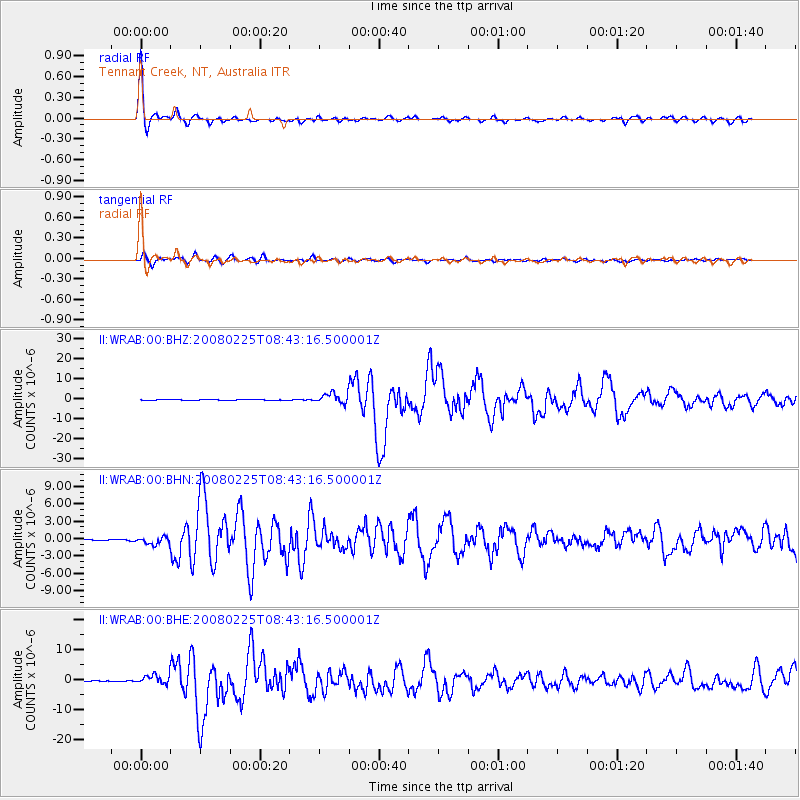
Earthquake location: Southern Sumatra, Indonesia
Earthquake latitude/longitude: -2.5/100.0
Earthquake time(UTC): 2008/02/25 (056) 08:36:33 GMT
Earthquake Depth: 25 km
Earthquake Magnitude: 6.4 MB, 7.3 MS, 7.0 MW, 6.9 MW
Earthquake Catalog/Contributor: WHDF/NEIC
Network: II Global Seismograph Network (GSN - IRIS/IDA)
Station: WRAB Tennant Creek, NT, Australia
Lat/Lon: 19.93 S/134.36 E
Elevation: 366 m
Distance: 37.8 deg
Az: 119.867 deg
Baz: 292.946 deg
Ray Param: 0.07589709
Estimated Moho Depth: 15.25 km
Estimated Crust Vp/Vs: 1.80
Assumed Crust Vp: 6.642 km/s
Estimated Crust Vs: 3.685 km/s
Estimated Crust Poisson's Ratio: 0.28
Radial Match: 97.46829 %
Radial Bump: 263
Transverse Match: 90.839806 %
Transverse Bump: 400
SOD ConfigId: 2564
Insert Time: 2010-03-01 23:13:46.525 +0000
GWidth: 2.5
Max Bumps: 400
Tol: 0.001

Signal To Noise

ChannelStoNSTALTA
II:WRAB:00:BHN:20080225T08:43:16.500001Z3.73295526.531245E-71.7496178E-7
II:WRAB:00:BHE:20080225T08:43:16.500001Z10.1116271.6595914E-61.6412704E-7
II:WRAB:00:BHZ:20080225T08:43:16.500001Z11.5372682.5664287E-62.2244684E-7
Arrivals
Ps2.0 SECOND
PpPs6.0 SECOND
PsPs/PpSs7.9 SECOND