WRAB Tennant Creek, NT, Australia - Earthquake Result Viewer
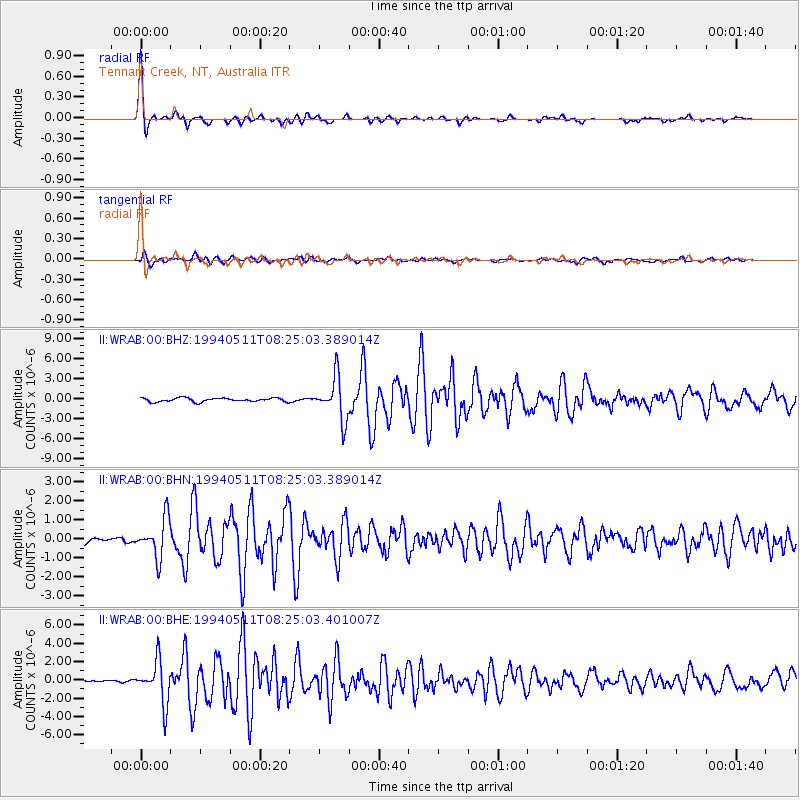
Earthquake location: Southern Sumatra, Indonesia
Earthquake latitude/longitude: -2.0/99.8
Earthquake time(UTC): 1994/05/11 (131) 08:18:16 GMT
Earthquake Depth: 28 km
Earthquake Magnitude: 6.0 MB, 6.3 MS, 6.0 UNKNOWN, 6.3 MW
Earthquake Catalog/Contributor: WHDF/NEIC
Network: II Global Seismograph Network (GSN - IRIS/IDA)
Station: WRAB Tennant Creek, NT, Australia
Lat/Lon: 19.93 S/134.36 E
Elevation: 366 m
Distance: 38.2 deg
Az: 120.302 deg
Baz: 293.489 deg
Ray Param: 0.07566032
Estimated Moho Depth: 14.5 km
Estimated Crust Vp/Vs: 1.89
Assumed Crust Vp: 6.642 km/s
Estimated Crust Vs: 3.519 km/s
Estimated Crust Poisson's Ratio: 0.30
Radial Match: 98.28638 %
Radial Bump: 256
Transverse Match: 86.06047 %
Transverse Bump: 400
SOD ConfigId: 61242
Insert Time: 2010-03-01 23:14:23.448 +0000
GWidth: 2.5
Max Bumps: 400
Tol: 0.001

Signal To Noise

ChannelStoNSTALTA
II:WRAB:00:BHN:19940511T08:25:03.389014Z4.2385311.027074E-62.4231838E-7
II:WRAB:00:BHE:19940511T08:25:03.401007Z28.2636642.3065777E-68.160929E-8
II:WRAB:00:BHZ:19940511T08:25:03.389014Z11.5751993.1733998E-62.741551E-7
Arrivals
Ps2.1 SECOND
PpPs5.9 SECOND
PsPs/PpSs7.9 SECOND