D51A Lot 18 Range III Mazenod Township, QC, CAN - Earthquake Result Viewer
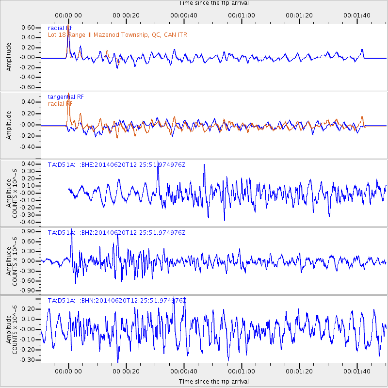
Earthquake location: Fox Islands, Aleutian Islands
Earthquake latitude/longitude: 51.9/-171.4
Earthquake time(UTC): 2014/06/20 (171) 12:16:46 GMT
Earthquake Depth: 26 km
Earthquake Magnitude: 5.6 MB, 5.0 ML, 5.1 ML, 5.3 MWB
Earthquake Catalog/Contributor: NEIC PDE/NEIC COMCAT
Network: TA USArray Transportable Network (new EarthScope stations)
Station: D51A Lot 18 Range III Mazenod Township, QC, CAN
Lat/Lon: 47.09 N/79.37 W
Elevation: 282 m
Distance: 56.0 deg
Az: 55.438 deg
Baz: 311.76 deg
Ray Param: 0.06437347
Estimated Moho Depth: 31.25 km
Estimated Crust Vp/Vs: 1.86
Assumed Crust Vp: 6.622 km/s
Estimated Crust Vs: 3.57 km/s
Estimated Crust Poisson's Ratio: 0.30
Radial Match: 80.79637 %
Radial Bump: 400
Transverse Match: 57.791977 %
Transverse Bump: 400
SOD ConfigId: 739768
Insert Time: 2014-07-04 12:50:22.963 +0000
GWidth: 2.5
Max Bumps: 400
Tol: 0.001

Signal To Noise

ChannelStoNSTALTA
TA:D51A: :BHZ:20140620T12:25:51.974976Z3.71881653.268514E-78.789123E-8
TA:D51A: :BHN:20140620T12:25:51.974976Z1.30058159.3529614E-87.191369E-8
TA:D51A: :BHE:20140620T12:25:51.974976Z1.84126871.4017311E-77.612855E-8
Arrivals
Ps4.3 SECOND
PpPs13 SECOND
PsPs/PpSs17 SECOND