You are here: Home > Network List > TA - USArray Transportable Network (new EarthScope stations) Stations List
> Station G05D Wamic, OR, USA > Earthquake Result Viewer
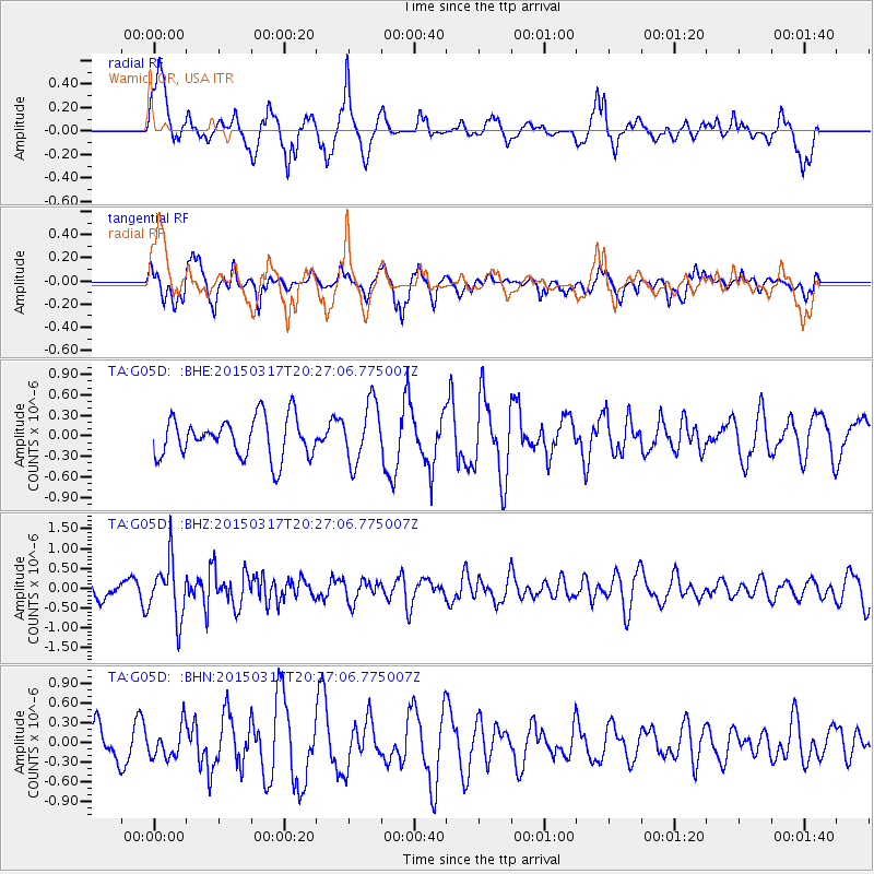
G05D Wamic, OR, USA - Earthquake Result Viewer
*The percent match for this event was below the threshold and hence no stack was calculated.
| Earthquake location: |
Fiji Islands Region |
| Earthquake latitude/longitude: |
-17.8/-178.6 |
| Earthquake time(UTC): |
2015/03/17 (076) 20:16:19 GMT |
| Earthquake Depth: |
556 km |
| Earthquake Magnitude: |
5.5 MWW, 5.6 MWC, 5.6 MWB |
| Earthquake Catalog/Contributor: |
NEIC PDE/NEIC COMCAT |
|
| Network: |
TA USArray Transportable Network (new EarthScope stations) |
| Station: |
G05D Wamic, OR, USA |
| Lat/Lon: |
45.24 N/121.32 W |
| Elevation: |
592 m |
|
| Distance: |
81.4 deg |
| Az: |
36.932 deg |
| Baz: |
234.113 deg |
| Ray Param: |
$rayparam |
*The percent match for this event was below the threshold and hence was not used in the summary stack. |
|
| Radial Match: |
68.110954 % |
| Radial Bump: |
400 |
| Transverse Match: |
55.975452 % |
| Transverse Bump: |
390 |
| SOD ConfigId: |
7422571 |
| Insert Time: |
2019-04-17 19:35:30.134 +0000 |
| GWidth: |
2.5 |
| Max Bumps: |
400 |
| Tol: |
0.001 |
|
Signal To Noise
| Channel | StoN | STA | LTA |
| TA:G05D: :BHZ:20150317T20:27:06.775007Z | 4.0562596 | 7.2245183E-7 | 1.7810788E-7 |
| TA:G05D: :BHN:20150317T20:27:06.775007Z | 0.6286453 | 2.387663E-7 | 3.7981084E-7 |
| TA:G05D: :BHE:20150317T20:27:06.775007Z | 1.5191483 | 4.3649888E-7 | 2.8733132E-7 |
| Arrivals |
| Ps | |
| PpPs | |
| PsPs/PpSs | |


