You are here: Home > Network List > TA - USArray Transportable Network (new EarthScope stations) Stations List
> Station J61A Chester, VT, USA > Earthquake Result Viewer
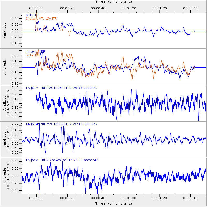
J61A Chester, VT, USA - Earthquake Result Viewer
*The percent match for this event was below the threshold and hence no stack was calculated.
| Earthquake location: |
Fox Islands, Aleutian Islands |
| Earthquake latitude/longitude: |
51.9/-171.4 |
| Earthquake time(UTC): |
2014/06/20 (171) 12:16:46 GMT |
| Earthquake Depth: |
26 km |
| Earthquake Magnitude: |
5.6 MB, 5.0 ML, 5.1 ML, 5.3 MWB |
| Earthquake Catalog/Contributor: |
NEIC PDE/NEIC COMCAT |
|
| Network: |
TA USArray Transportable Network (new EarthScope stations) |
| Station: |
J61A Chester, VT, USA |
| Lat/Lon: |
43.35 N/72.55 W |
| Elevation: |
253 m |
|
| Distance: |
62.1 deg |
| Az: |
54.673 deg |
| Baz: |
316.196 deg |
| Ray Param: |
$rayparam |
*The percent match for this event was below the threshold and hence was not used in the summary stack. |
|
| Radial Match: |
40.00672 % |
| Radial Bump: |
400 |
| Transverse Match: |
39.2974 % |
| Transverse Bump: |
400 |
| SOD ConfigId: |
739768 |
| Insert Time: |
2014-07-04 12:57:17.620 +0000 |
| GWidth: |
2.5 |
| Max Bumps: |
400 |
| Tol: |
0.001 |
|
Signal To Noise
| Channel | StoN | STA | LTA |
| TA:J61A: :BHZ:20140620T12:26:33.900024Z | 3.0462418 | 2.427954E-7 | 7.970326E-8 |
| TA:J61A: :BHN:20140620T12:26:33.900024Z | 2.0911322 | 1.5768994E-7 | 7.5408884E-8 |
| TA:J61A: :BHE:20140620T12:26:33.900024Z | 1.0691854 | 1.0541922E-7 | 9.8597695E-8 |
| Arrivals |
| Ps | |
| PpPs | |
| PsPs/PpSs | |


