You are here: Home > Network List > US - United States National Seismic Network Stations List
> Station EGMT Eagleton, Montana, USA > Earthquake Result Viewer
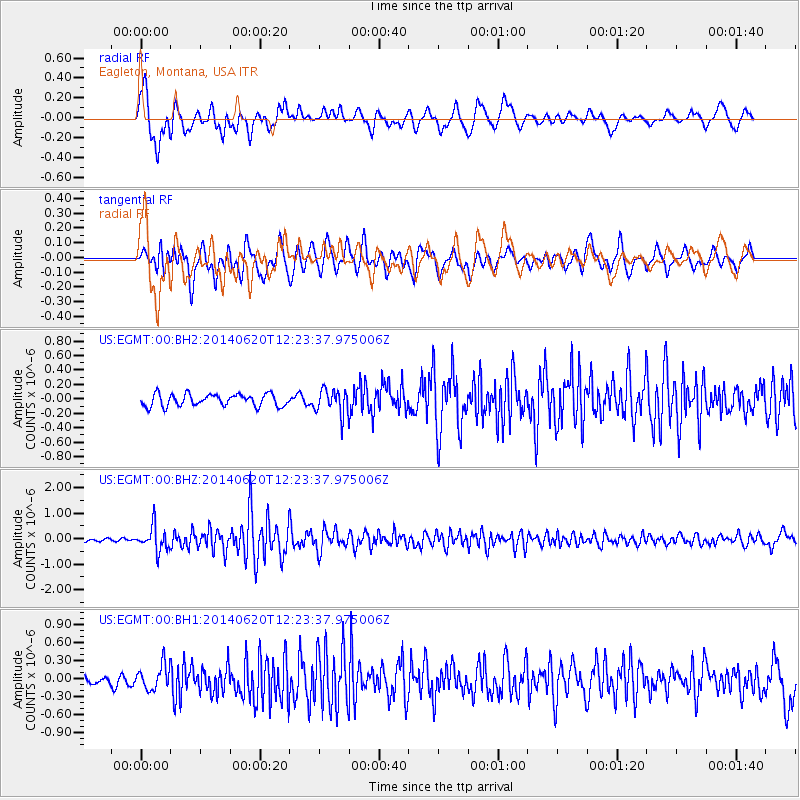
EGMT Eagleton, Montana, USA - Earthquake Result Viewer
*The percent match for this event was below the threshold and hence no stack was calculated.
| Earthquake location: |
Fox Islands, Aleutian Islands |
| Earthquake latitude/longitude: |
51.9/-171.4 |
| Earthquake time(UTC): |
2014/06/20 (171) 12:16:46 GMT |
| Earthquake Depth: |
26 km |
| Earthquake Magnitude: |
5.6 MB, 5.0 ML, 5.1 ML, 5.3 MWB |
| Earthquake Catalog/Contributor: |
NEIC PDE/NEIC COMCAT |
|
| Network: |
US United States National Seismic Network |
| Station: |
EGMT Eagleton, Montana, USA |
| Lat/Lon: |
48.02 N/109.75 W |
| Elevation: |
1055 m |
|
| Distance: |
38.8 deg |
| Az: |
70.602 deg |
| Baz: |
299.582 deg |
| Ray Param: |
$rayparam |
*The percent match for this event was below the threshold and hence was not used in the summary stack. |
|
| Radial Match: |
77.39439 % |
| Radial Bump: |
400 |
| Transverse Match: |
72.301025 % |
| Transverse Bump: |
400 |
| SOD ConfigId: |
739768 |
| Insert Time: |
2014-07-04 13:10:06.023 +0000 |
| GWidth: |
2.5 |
| Max Bumps: |
400 |
| Tol: |
0.001 |
|
Signal To Noise
| Channel | StoN | STA | LTA |
| US:EGMT:00:BHZ:20140620T12:23:37.975006Z | 9.442038 | 4.8381986E-7 | 5.124104E-8 |
| US:EGMT:00:BH1:20140620T12:23:37.975006Z | 1.3623532 | 1.9982305E-7 | 1.4667492E-7 |
| US:EGMT:00:BH2:20140620T12:23:37.975006Z | 2.0347078 | 1.703496E-7 | 8.3721886E-8 |
| Arrivals |
| Ps | |
| PpPs | |
| PsPs/PpSs | |


