You are here: Home > Network List > CI - Caltech Regional Seismic Network Stations List
> Station VCS Vincent SCE, California, USA > Earthquake Result Viewer
VCS Vincent SCE, California, USA - Earthquake Result Viewer

| Earthquake location: |
Near Coast Of Ecuador |
| Earthquake latitude/longitude: |
-0.2/-80.6 |
| Earthquake time(UTC): |
2000/09/28 (272) 23:23:43 GMT |
| Earthquake Depth: |
23 km |
| Earthquake Magnitude: |
5.8 MB, 6.0 MS, 6.6 MW, 6.4 MW |
| Earthquake Catalog/Contributor: |
WHDF/NEIC |
|
| Network: |
CI Caltech Regional Seismic Network |
| Station: |
VCS Vincent SCE, California, USA |
| Lat/Lon: |
34.48 N/118.11 W |
| Elevation: |
962 m |
|
| Distance: |
49.2 deg |
| Az: |
318.362 deg |
| Baz: |
126.455 deg |
| Ray Param: |
0.068797365 |
| Estimated Moho Depth: |
24.75 km |
| Estimated Crust Vp/Vs: |
1.96 |
| Assumed Crust Vp: |
6.1 km/s |
| Estimated Crust Vs: |
3.108 km/s |
| Estimated Crust Poisson's Ratio: |
0.32 |
|
| Radial Match: |
89.99617 % |
| Radial Bump: |
400 |
| Transverse Match: |
85.25088 % |
| Transverse Bump: |
400 |
| SOD ConfigId: |
3744 |
| Insert Time: |
2010-02-25 21:08:51.334 +0000 |
| GWidth: |
2.5 |
| Max Bumps: |
400 |
| Tol: |
0.001 |
|
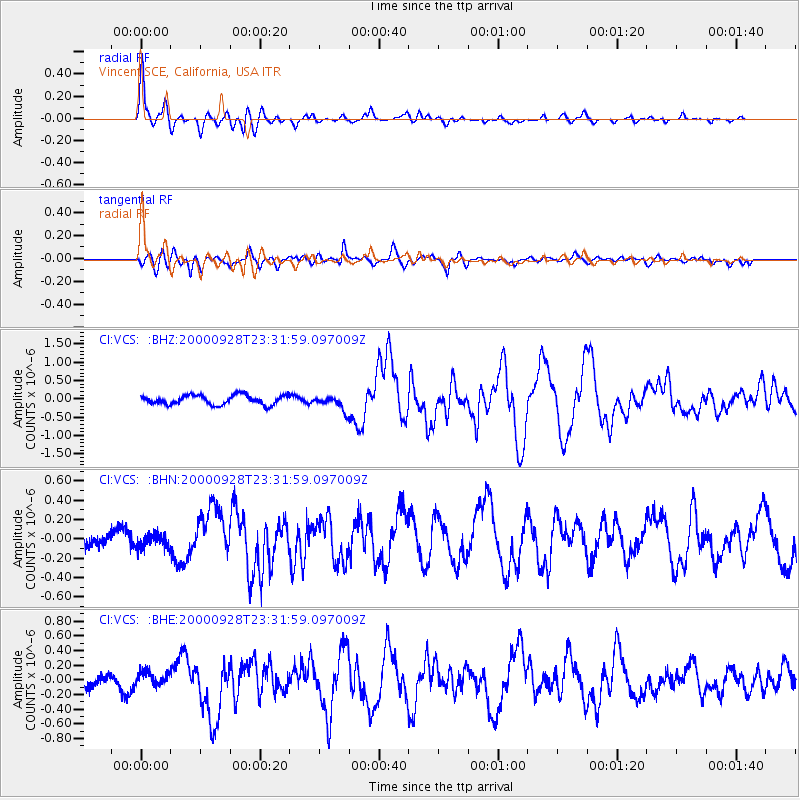
Signal To Noise
| Channel | StoN | STA | LTA |
| CI:VCS: :BHN:20000928T23:31:59.097009Z | 0.93259406 | 7.335166E-8 | 7.865336E-8 |
| CI:VCS: :BHE:20000928T23:31:59.097009Z | 1.2652005 | 9.200682E-8 | 7.2721136E-8 |
| CI:VCS: :BHZ:20000928T23:31:59.097009Z | 1.5774293 | 1.9961007E-7 | 1.2654138E-7 |
| Arrivals |
| Ps | 4.1 SECOND |
| PpPs | 11 SECOND |
| PsPs/PpSs | 16 SECOND |


