You are here: Home > Network List > CN - Canadian National Seismograph Network Stations List
> Station INK INUVIK, NT > Earthquake Result Viewer
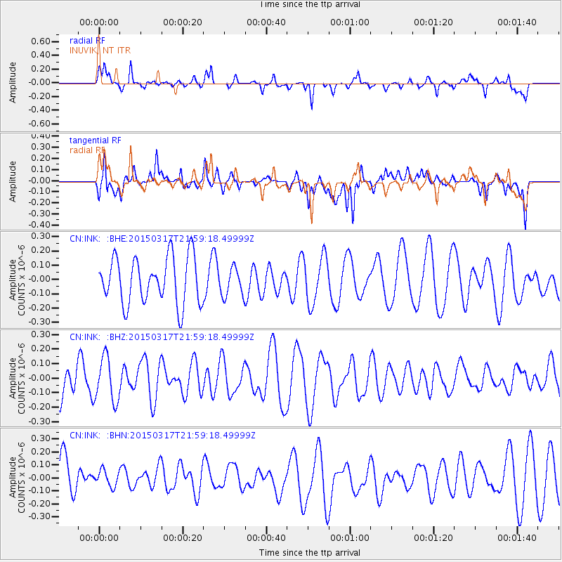
INK INUVIK, NT - Earthquake Result Viewer
*The percent match for this event was below the threshold and hence no stack was calculated.
| Earthquake location: |
Kuril Islands |
| Earthquake latitude/longitude: |
44.2/149.2 |
| Earthquake time(UTC): |
2015/03/17 (076) 21:51:37 GMT |
| Earthquake Depth: |
55 km |
| Earthquake Magnitude: |
3.7 mb |
| Earthquake Catalog/Contributor: |
ISC/ISC |
|
| Network: |
CN Canadian National Seismograph Network |
| Station: |
INK INUVIK, NT |
| Lat/Lon: |
68.31 N/133.53 W |
| Elevation: |
44 m |
|
| Distance: |
45.2 deg |
| Az: |
30.718 deg |
| Baz: |
279.005 deg |
| Ray Param: |
$rayparam |
*The percent match for this event was below the threshold and hence was not used in the summary stack. |
|
| Radial Match: |
51.350487 % |
| Radial Bump: |
290 |
| Transverse Match: |
54.851536 % |
| Transverse Bump: |
400 |
| SOD ConfigId: |
7422571 |
| Insert Time: |
2019-04-17 19:39:45.409 +0000 |
| GWidth: |
2.5 |
| Max Bumps: |
400 |
| Tol: |
0.001 |
|
Signal To Noise
| Channel | StoN | STA | LTA |
| CN:INK: :BHZ:20150317T21:59:18.49999Z | 1.7942445 | 1.5242958E-7 | 8.4954735E-8 |
| CN:INK: :BHN:20150317T21:59:18.49999Z | 0.53151196 | 7.087575E-8 | 1.3334741E-7 |
| CN:INK: :BHE:20150317T21:59:18.49999Z | 0.61824477 | 1.01065176E-7 | 1.6347113E-7 |
| Arrivals |
| Ps | |
| PpPs | |
| PsPs/PpSs | |


