You are here: Home > Network List > TA - USArray Transportable Network (new EarthScope stations) Stations List
> Station R54A Victor, WV, USA > Earthquake Result Viewer
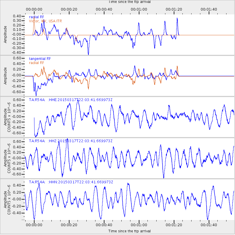
R54A Victor, WV, USA - Earthquake Result Viewer
*The percent match for this event was below the threshold and hence no stack was calculated.
| Earthquake location: |
Kuril Islands |
| Earthquake latitude/longitude: |
44.2/149.2 |
| Earthquake time(UTC): |
2015/03/17 (076) 21:51:37 GMT |
| Earthquake Depth: |
55 km |
| Earthquake Magnitude: |
3.7 mb |
| Earthquake Catalog/Contributor: |
ISC/ISC |
|
| Network: |
TA USArray Transportable Network (new EarthScope stations) |
| Station: |
R54A Victor, WV, USA |
| Lat/Lon: |
38.18 N/80.99 W |
| Elevation: |
512 m |
|
| Distance: |
86.2 deg |
| Az: |
37.369 deg |
| Baz: |
326.383 deg |
| Ray Param: |
$rayparam |
*The percent match for this event was below the threshold and hence was not used in the summary stack. |
|
| Radial Match: |
44.261612 % |
| Radial Bump: |
400 |
| Transverse Match: |
66.63946 % |
| Transverse Bump: |
400 |
| SOD ConfigId: |
7422571 |
| Insert Time: |
2019-04-17 19:43:20.589 +0000 |
| GWidth: |
2.5 |
| Max Bumps: |
400 |
| Tol: |
0.001 |
|
Signal To Noise
| Channel | StoN | STA | LTA |
| TA:R54A: :HHZ:20150317T22:03:41.669973Z | 1.0069642 | 2.4333082E-7 | 2.4164794E-7 |
| TA:R54A: :HHN:20150317T22:03:41.669973Z | 1.7395574 | 3.4730704E-7 | 1.9965252E-7 |
| TA:R54A: :HHE:20150317T22:03:41.669973Z | 0.8762603 | 2.7730033E-7 | 3.1645885E-7 |
| Arrivals |
| Ps | |
| PpPs | |
| PsPs/PpSs | |


