You are here: Home > Network List > US - United States National Seismic Network Stations List
> Station WMOK Wichita Mountains, Oklahoma, USA > Earthquake Result Viewer
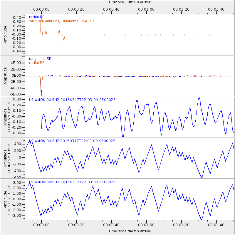
WMOK Wichita Mountains, Oklahoma, USA - Earthquake Result Viewer
*The percent match for this event was below the threshold and hence no stack was calculated.
| Earthquake location: |
Kuril Islands |
| Earthquake latitude/longitude: |
44.2/149.2 |
| Earthquake time(UTC): |
2015/03/17 (076) 21:51:37 GMT |
| Earthquake Depth: |
55 km |
| Earthquake Magnitude: |
3.7 mb |
| Earthquake Catalog/Contributor: |
ISC/ISC |
|
| Network: |
US United States National Seismic Network |
| Station: |
WMOK Wichita Mountains, Oklahoma, USA |
| Lat/Lon: |
34.74 N/98.78 W |
| Elevation: |
486 m |
|
| Distance: |
80.1 deg |
| Az: |
50.831 deg |
| Baz: |
317.411 deg |
| Ray Param: |
$rayparam |
*The percent match for this event was below the threshold and hence was not used in the summary stack. |
|
| Radial Match: |
98.29568 % |
| Radial Bump: |
122 |
| Transverse Match: |
98.34997 % |
| Transverse Bump: |
94 |
| SOD ConfigId: |
7422571 |
| Insert Time: |
2019-04-17 19:43:58.778 +0000 |
| GWidth: |
2.5 |
| Max Bumps: |
400 |
| Tol: |
0.001 |
|
Signal To Noise
| Channel | StoN | STA | LTA |
| US:WMOK:00:BHZ:20150317T22:03:09.950002Z | 1.6166524 | 4.2420157E-4 | 2.6239504E-4 |
| US:WMOK:00:BH1:20150317T22:03:09.950002Z | 2.3878613 | 3.2338367E-6 | 1.3542816E-6 |
| US:WMOK:00:BH2:20150317T22:03:09.950002Z | 1.0103523 | 1.2277071E-7 | 1.2151278E-7 |
| Arrivals |
| Ps | |
| PpPs | |
| PsPs/PpSs | |


