
WRAB Tennant Creek, NT, Australia - Earthquake Result Viewer
| ||||||||||||||||||
| ||||||||||||||||||
| ||||||||||||||||||
|
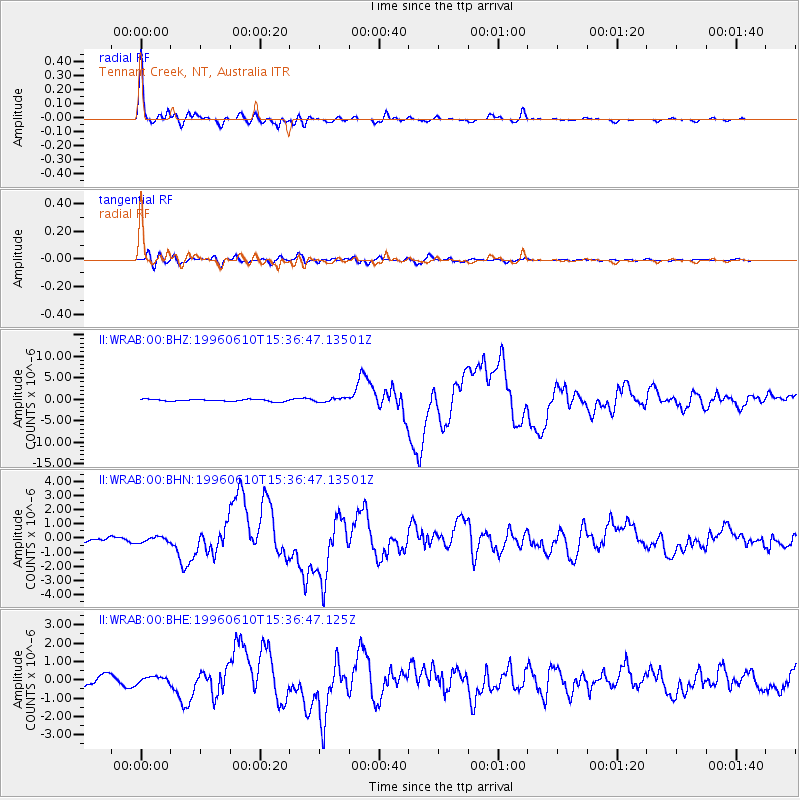
Signal To Noise
| Channel | StoN | STA | LTA |
| II:WRAB:00:BHN:19960610T15:36:47.13501Z | 1.2034175 | 1.9096504E-7 | 1.586856E-7 |
| II:WRAB:00:BHE:19960610T15:36:47.125Z | 0.694455 | 1.7601852E-7 | 2.534628E-7 |
| II:WRAB:00:BHZ:19960610T15:36:47.13501Z | 1.9163826 | 4.6488233E-7 | 2.4258324E-7 |
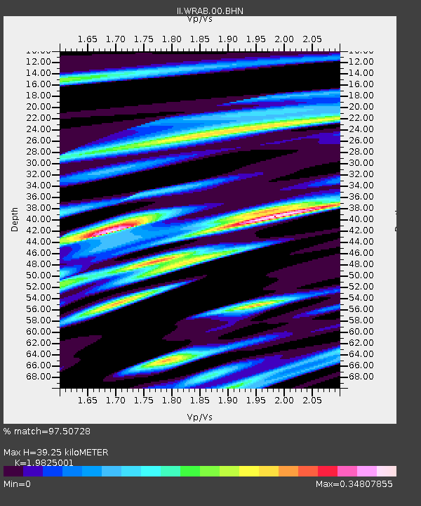
| Arrivals | |
| Ps | 6.0 SECOND |
| PpPs | 17 SECOND |
| PsPs/PpSs | 23 SECOND |

