You are here: Home > Network List > TA - USArray Transportable Network (new EarthScope stations) Stations List
> Station U59A Littleton, NC, USA > Earthquake Result Viewer
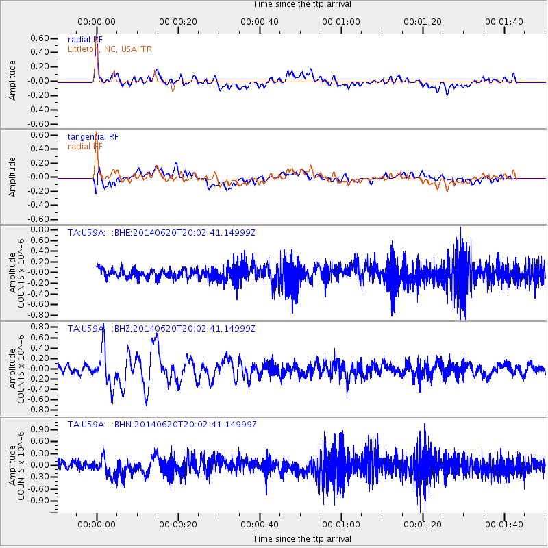
U59A Littleton, NC, USA - Earthquake Result Viewer
*The percent match for this event was below the threshold and hence no stack was calculated.
| Earthquake location: |
Near Coast Of Northern Chile |
| Earthquake latitude/longitude: |
-19.8/-70.9 |
| Earthquake time(UTC): |
2014/06/20 (171) 19:53:32 GMT |
| Earthquake Depth: |
14 km |
| Earthquake Magnitude: |
5.5 MB |
| Earthquake Catalog/Contributor: |
NEIC PDE/NEIC COMCAT |
|
| Network: |
TA USArray Transportable Network (new EarthScope stations) |
| Station: |
U59A Littleton, NC, USA |
| Lat/Lon: |
36.35 N/77.79 W |
| Elevation: |
99 m |
|
| Distance: |
56.2 deg |
| Az: |
353.275 deg |
| Baz: |
172.151 deg |
| Ray Param: |
$rayparam |
*The percent match for this event was below the threshold and hence was not used in the summary stack. |
|
| Radial Match: |
72.640366 % |
| Radial Bump: |
400 |
| Transverse Match: |
61.817722 % |
| Transverse Bump: |
400 |
| SOD ConfigId: |
739768 |
| Insert Time: |
2014-07-04 20:41:29.263 +0000 |
| GWidth: |
2.5 |
| Max Bumps: |
400 |
| Tol: |
0.001 |
|
Signal To Noise
| Channel | StoN | STA | LTA |
| TA:U59A: :BHZ:20140620T20:02:41.14999Z | 6.262533 | 3.5589147E-7 | 5.6828675E-8 |
| TA:U59A: :BHN:20140620T20:02:41.14999Z | 3.1491575 | 2.3297501E-7 | 7.398011E-8 |
| TA:U59A: :BHE:20140620T20:02:41.14999Z | 1.9507602 | 1.5679854E-7 | 8.037817E-8 |
| Arrivals |
| Ps | |
| PpPs | |
| PsPs/PpSs | |


