You are here: Home > Network List > G - GEOSCOPE Stations List
> Station INU Inuyama, Japan > Earthquake Result Viewer
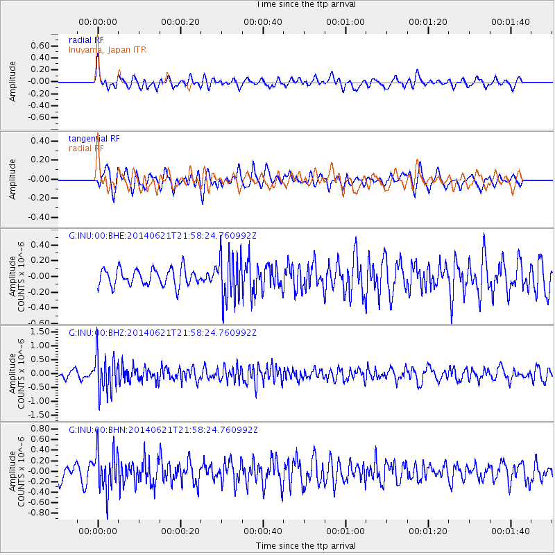
INU Inuyama, Japan - Earthquake Result Viewer
*The percent match for this event was below the threshold and hence no stack was calculated.
| Earthquake location: |
Minahassa Peninsula, Sulawesi |
| Earthquake latitude/longitude: |
-0.1/123.0 |
| Earthquake time(UTC): |
2014/06/21 (172) 21:51:51 GMT |
| Earthquake Depth: |
115 km |
| Earthquake Magnitude: |
5.5 MB |
| Earthquake Catalog/Contributor: |
NEIC PDE/NEIC COMCAT |
|
| Network: |
G GEOSCOPE |
| Station: |
INU Inuyama, Japan |
| Lat/Lon: |
35.35 N/137.03 E |
| Elevation: |
132 m |
|
| Distance: |
37.7 deg |
| Az: |
18.923 deg |
| Baz: |
203.373 deg |
| Ray Param: |
$rayparam |
*The percent match for this event was below the threshold and hence was not used in the summary stack. |
|
| Radial Match: |
66.83453 % |
| Radial Bump: |
400 |
| Transverse Match: |
61.92366 % |
| Transverse Bump: |
400 |
| SOD ConfigId: |
739768 |
| Insert Time: |
2014-07-05 22:02:07.632 +0000 |
| GWidth: |
2.5 |
| Max Bumps: |
400 |
| Tol: |
0.001 |
|
Signal To Noise
| Channel | StoN | STA | LTA |
| G:INU:00:BHZ:20140621T21:58:24.760992Z | 3.8527324 | 6.691695E-7 | 1.7368698E-7 |
| G:INU:00:BHN:20140621T21:58:24.760992Z | 3.0268614 | 3.8865196E-7 | 1.2840097E-7 |
| G:INU:00:BHE:20140621T21:58:24.760992Z | 2.7564654 | 2.940018E-7 | 1.06658995E-7 |
| Arrivals |
| Ps | |
| PpPs | |
| PsPs/PpSs | |


