You are here: Home > Network List > IC - New China Digital Seismograph Network Stations List
> Station KMI Kunming, Yunnan Province, China > Earthquake Result Viewer
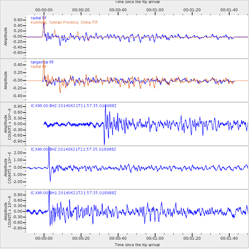
KMI Kunming, Yunnan Province, China - Earthquake Result Viewer
*The percent match for this event was below the threshold and hence no stack was calculated.
| Earthquake location: |
Minahassa Peninsula, Sulawesi |
| Earthquake latitude/longitude: |
-0.1/123.0 |
| Earthquake time(UTC): |
2014/06/21 (172) 21:51:51 GMT |
| Earthquake Depth: |
115 km |
| Earthquake Magnitude: |
5.5 MB |
| Earthquake Catalog/Contributor: |
NEIC PDE/NEIC COMCAT |
|
| Network: |
IC New China Digital Seismograph Network |
| Station: |
KMI Kunming, Yunnan Province, China |
| Lat/Lon: |
25.12 N/102.74 E |
| Elevation: |
1975 m |
|
| Distance: |
31.9 deg |
| Az: |
323.502 deg |
| Baz: |
138.993 deg |
| Ray Param: |
$rayparam |
*The percent match for this event was below the threshold and hence was not used in the summary stack. |
|
| Radial Match: |
76.7004 % |
| Radial Bump: |
400 |
| Transverse Match: |
69.16469 % |
| Transverse Bump: |
400 |
| SOD ConfigId: |
739768 |
| Insert Time: |
2014-07-05 22:03:46.512 +0000 |
| GWidth: |
2.5 |
| Max Bumps: |
400 |
| Tol: |
0.001 |
|
Signal To Noise
| Channel | StoN | STA | LTA |
| IC:KMI:00:BHZ:20140621T21:57:35.018988Z | 14.441418 | 8.526403E-7 | 5.904132E-8 |
| IC:KMI:00:BH1:20140621T21:57:35.018988Z | 5.2728424 | 3.6388857E-7 | 6.901184E-8 |
| IC:KMI:00:BH2:20140621T21:57:35.018988Z | 6.877877 | 3.7923687E-7 | 5.5138653E-8 |
| Arrivals |
| Ps | |
| PpPs | |
| PsPs/PpSs | |


