
WRAB Tennant Creek, NT, Australia - Earthquake Result Viewer
| ||||||||||||||||||
| ||||||||||||||||||
| ||||||||||||||||||
|
Signal To Noise
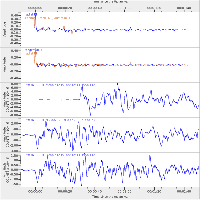
| Channel | StoN | STA | LTA |
| II:WRAB:00:BHN:20071219T09:42:11.499014Z | 17.57104 | 1.1099501E-6 | 6.316929E-8 |
| II:WRAB:00:BHE:20071219T09:42:11.499014Z | 10.018775 | 6.2110223E-7 | 6.199383E-8 |
| II:WRAB:00:BHZ:20071219T09:42:11.499014Z | 44.062035 | 3.1660718E-6 | 7.185487E-8 |
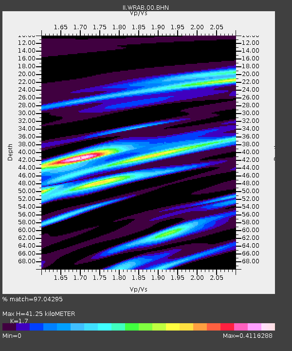
| Arrivals | |
| Ps | 4.5 SECOND |
| PpPs | 16 SECOND |
| PsPs/PpSs | 21 SECOND |

