WRAB Tennant Creek, NT, Australia - Earthquake Result Viewer
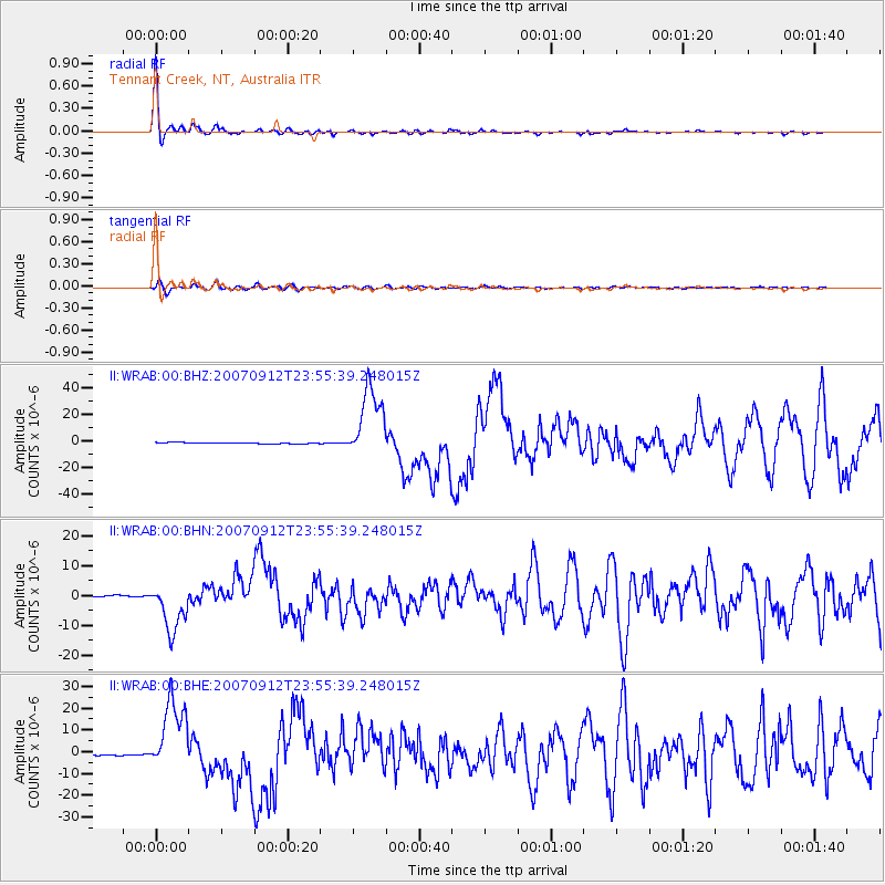
Earthquake location: Southern Sumatra, Indonesia
Earthquake latitude/longitude: -2.6/100.8
Earthquake time(UTC): 2007/09/12 (255) 23:49:03 GMT
Earthquake Depth: 35 km
Earthquake Magnitude: 6.6 MB, 8.1 MS, 7.9 MW, 7.6 ME
Earthquake Catalog/Contributor: WHDF/NEIC
Network: II Global Seismograph Network (GSN - IRIS/IDA)
Station: WRAB Tennant Creek, NT, Australia
Lat/Lon: 19.93 S/134.36 E
Elevation: 366 m
Distance: 37.0 deg
Az: 120.241 deg
Baz: 293.465 deg
Ray Param: 0.076325044
Estimated Moho Depth: 13.25 km
Estimated Crust Vp/Vs: 2.10
Assumed Crust Vp: 6.642 km/s
Estimated Crust Vs: 3.167 km/s
Estimated Crust Poisson's Ratio: 0.35
Radial Match: 98.58941 %
Radial Bump: 227
Transverse Match: 90.49077 %
Transverse Bump: 400
SOD ConfigId: 2564
Insert Time: 2010-03-01 23:19:32.007 +0000
GWidth: 2.5
Max Bumps: 400
Tol: 0.001

Signal To Noise

ChannelStoNSTALTA
II:WRAB:00:BHN:20070912T23:55:39.248015Z37.1787728.168179E-62.1970007E-7
II:WRAB:00:BHE:20070912T23:55:39.248015Z41.2024651.6923057E-54.1072923E-7
II:WRAB:00:BHZ:20070912T23:55:39.248015Z61.644532.7631468E-54.4823875E-7
Arrivals
Ps2.3 SECOND
PpPs5.8 SECOND
PsPs/PpSs8.1 SECOND