You are here: Home > Network List > TA - USArray Transportable Network (new EarthScope stations) Stations List
> Station Z41A Richland Creek Farm, El Dorado, AR, USA > Earthquake Result Viewer
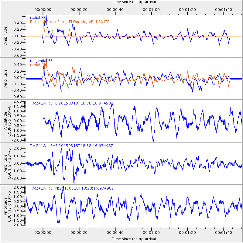
Z41A Richland Creek Farm, El Dorado, AR, USA - Earthquake Result Viewer
*The percent match for this event was below the threshold and hence no stack was calculated.
| Earthquake location: |
Near Coast Of Central Chile |
| Earthquake latitude/longitude: |
-36.1/-73.6 |
| Earthquake time(UTC): |
2015/03/18 (077) 18:27:28 GMT |
| Earthquake Depth: |
10 km |
| Earthquake Magnitude: |
6.2 MWB, 6.2 MWW |
| Earthquake Catalog/Contributor: |
NEIC PDE/NEIC COMCAT |
|
| Network: |
TA USArray Transportable Network (new EarthScope stations) |
| Station: |
Z41A Richland Creek Farm, El Dorado, AR, USA |
| Lat/Lon: |
33.26 N/92.80 W |
| Elevation: |
62 m |
|
| Distance: |
71.3 deg |
| Az: |
343.106 deg |
| Baz: |
163.687 deg |
| Ray Param: |
$rayparam |
*The percent match for this event was below the threshold and hence was not used in the summary stack. |
|
| Radial Match: |
74.71251 % |
| Radial Bump: |
400 |
| Transverse Match: |
64.88621 % |
| Transverse Bump: |
400 |
| SOD ConfigId: |
7422571 |
| Insert Time: |
2019-04-17 19:57:02.160 +0000 |
| GWidth: |
2.5 |
| Max Bumps: |
400 |
| Tol: |
0.001 |
|
Signal To Noise
| Channel | StoN | STA | LTA |
| TA:Z41A: :BHZ:20150318T18:38:16.97498Z | 1.834543 | 4.5548921E-7 | 2.4828483E-7 |
| TA:Z41A: :BHN:20150318T18:38:16.97498Z | 0.6305467 | 3.4519067E-7 | 5.4744663E-7 |
| TA:Z41A: :BHE:20150318T18:38:16.97498Z | 1.5757762 | 8.028398E-7 | 5.094885E-7 |
| Arrivals |
| Ps | |
| PpPs | |
| PsPs/PpSs | |


