You are here: Home > Network List > UW - Pacific Northwest Regional Seismic Network Stations List
> Station PASS Maple Falls, WA, USA > Earthquake Result Viewer
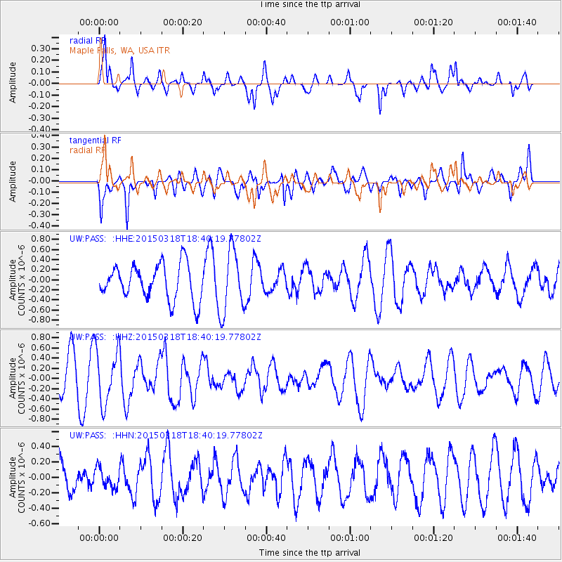
PASS Maple Falls, WA, USA - Earthquake Result Viewer
*The percent match for this event was below the threshold and hence no stack was calculated.
| Earthquake location: |
Near Coast Of Central Chile |
| Earthquake latitude/longitude: |
-36.1/-73.6 |
| Earthquake time(UTC): |
2015/03/18 (077) 18:27:28 GMT |
| Earthquake Depth: |
10 km |
| Earthquake Magnitude: |
6.2 MWB, 6.2 MWW |
| Earthquake Catalog/Contributor: |
NEIC PDE/NEIC COMCAT |
|
| Network: |
UW Pacific Northwest Regional Seismic Network |
| Station: |
PASS Maple Falls, WA, USA |
| Lat/Lon: |
49.00 N/122.09 W |
| Elevation: |
174 m |
|
| Distance: |
95.0 deg |
| Az: |
330.34 deg |
| Baz: |
142.516 deg |
| Ray Param: |
$rayparam |
*The percent match for this event was below the threshold and hence was not used in the summary stack. |
|
| Radial Match: |
84.13179 % |
| Radial Bump: |
373 |
| Transverse Match: |
58.8464 % |
| Transverse Bump: |
400 |
| SOD ConfigId: |
7422571 |
| Insert Time: |
2019-04-17 19:57:44.196 +0000 |
| GWidth: |
2.5 |
| Max Bumps: |
400 |
| Tol: |
0.001 |
|
Signal To Noise
| Channel | StoN | STA | LTA |
| UW:PASS: :HHZ:20150318T18:40:19.77802Z | 1.5864772 | 5.2651933E-7 | 3.3187956E-7 |
| UW:PASS: :HHN:20150318T18:40:19.77802Z | 0.6652117 | 1.2976174E-7 | 1.9506834E-7 |
| UW:PASS: :HHE:20150318T18:40:19.77802Z | 1.8051149 | 6.309296E-7 | 3.4952325E-7 |
| Arrivals |
| Ps | |
| PpPs | |
| PsPs/PpSs | |


