WRAB Tennant Creek, NT, Australia - Earthquake Result Viewer
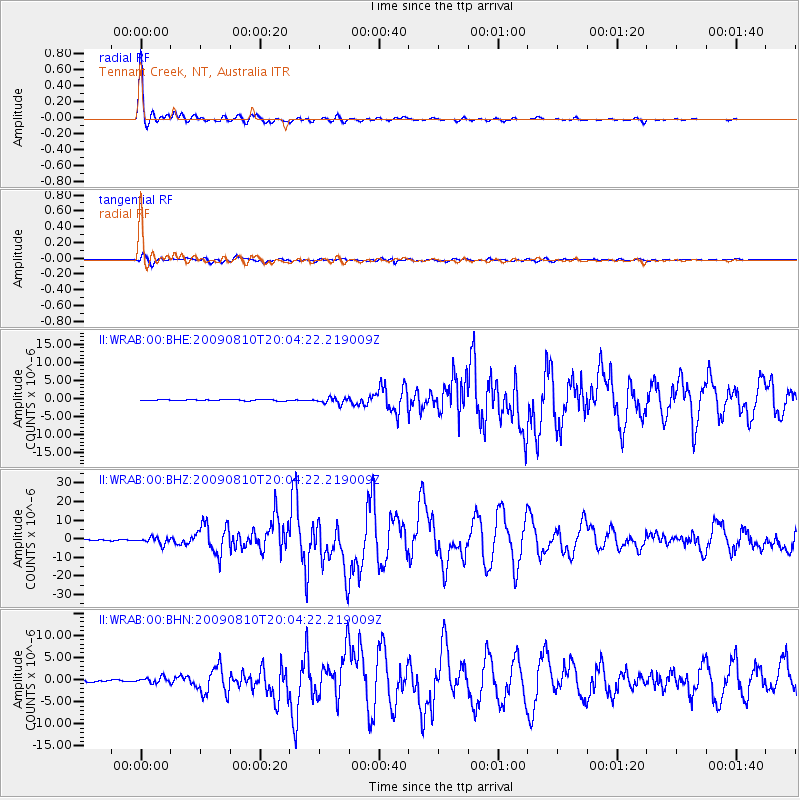
Earthquake location: Andaman Islands, India Region
Earthquake latitude/longitude: 14.1/92.9
Earthquake time(UTC): 2009/08/10 (222) 19:55:35 GMT
Earthquake Depth: 4.7 km
Earthquake Magnitude: 6.9 MB, 7.6 MS, 7.5 MW, 7.5 MW
Earthquake Catalog/Contributor: WHDF/NEIC
Network: II Global Seismograph Network (GSN - IRIS/IDA)
Station: WRAB Tennant Creek, NT, Australia
Lat/Lon: 19.93 S/134.36 E
Elevation: 366 m
Distance: 53.0 deg
Az: 128.717 deg
Baz: 306.423 deg
Ray Param: 0.06641278
Estimated Moho Depth: 39.75 km
Estimated Crust Vp/Vs: 1.90
Assumed Crust Vp: 6.642 km/s
Estimated Crust Vs: 3.491 km/s
Estimated Crust Poisson's Ratio: 0.31
Radial Match: 99.14321 %
Radial Bump: 308
Transverse Match: 94.27005 %
Transverse Bump: 400
SOD ConfigId: 2622
Insert Time: 2010-03-01 23:19:45.638 +0000
GWidth: 2.5
Max Bumps: 400
Tol: 0.001

Signal To Noise

ChannelStoNSTALTA
II:WRAB:00:BHZ:20090810T20:04:22.219009Z8.3007121.838635E-62.2150329E-7
II:WRAB:00:BHN:20090810T20:04:22.219009Z2.93209156.7043726E-72.2865495E-7
II:WRAB:00:BHE:20090810T20:04:22.219009Z5.66783148.436171E-71.4884301E-7
Arrivals
Ps5.7 SECOND
PpPs16 SECOND
PsPs/PpSs22 SECOND