You are here: Home > Network List > TA - USArray Transportable Network (new EarthScope stations) Stations List
> Station Z41A Richland Creek Farm, El Dorado, AR, USA > Earthquake Result Viewer
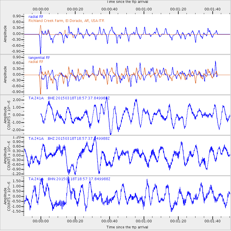
Z41A Richland Creek Farm, El Dorado, AR, USA - Earthquake Result Viewer
*The percent match for this event was below the threshold and hence no stack was calculated.
| Earthquake location: |
Near Coast Of Central Chile |
| Earthquake latitude/longitude: |
-36.3/-73.5 |
| Earthquake time(UTC): |
2015/03/18 (077) 18:46:46 GMT |
| Earthquake Depth: |
0.0 km |
| Earthquake Magnitude: |
4.1 mb, 5.5 Ms1, 4.3 mb1, 3.9 mb1mx, 4.1 mbtmp, 5.5 MS, 4.2 ms1mx |
| Earthquake Catalog/Contributor: |
ISC/ISC |
|
| Network: |
TA USArray Transportable Network (new EarthScope stations) |
| Station: |
Z41A Richland Creek Farm, El Dorado, AR, USA |
| Lat/Lon: |
33.26 N/92.80 W |
| Elevation: |
62 m |
|
| Distance: |
71.5 deg |
| Az: |
342.99 deg |
| Baz: |
163.618 deg |
| Ray Param: |
$rayparam |
*The percent match for this event was below the threshold and hence was not used in the summary stack. |
|
| Radial Match: |
49.288105 % |
| Radial Bump: |
400 |
| Transverse Match: |
52.73683 % |
| Transverse Bump: |
400 |
| SOD ConfigId: |
7422571 |
| Insert Time: |
2019-04-17 20:03:44.585 +0000 |
| GWidth: |
2.5 |
| Max Bumps: |
400 |
| Tol: |
0.001 |
|
Signal To Noise
| Channel | StoN | STA | LTA |
| TA:Z41A: :BHZ:20150318T18:57:37.849988Z | 1.496388 | 3.9443572E-7 | 2.635919E-7 |
| TA:Z41A: :BHN:20150318T18:57:37.849988Z | 2.0523486 | 1.1489237E-6 | 5.598093E-7 |
| TA:Z41A: :BHE:20150318T18:57:37.849988Z | 1.247511 | 8.815794E-7 | 7.066707E-7 |
| Arrivals |
| Ps | |
| PpPs | |
| PsPs/PpSs | |


