You are here: Home > Network List > US - United States National Seismic Network Stations List
> Station TPNV Topopah Spring, Nevada, USA > Earthquake Result Viewer
TPNV Topopah Spring, Nevada, USA - Earthquake Result Viewer

| Earthquake location: |
Kermadec Islands, New Zealand |
| Earthquake latitude/longitude: |
-30.1/-177.7 |
| Earthquake time(UTC): |
2014/06/23 (174) 19:19:16 GMT |
| Earthquake Depth: |
20 km |
| Earthquake Magnitude: |
6.9 MWW, 6.7 MWB, 7.2 MI |
| Earthquake Catalog/Contributor: |
NEIC PDE/NEIC COMCAT |
|
| Network: |
US United States National Seismic Network |
| Station: |
TPNV Topopah Spring, Nevada, USA |
| Lat/Lon: |
36.95 N/116.25 W |
| Elevation: |
1600 m |
|
| Distance: |
88.1 deg |
| Az: |
44.739 deg |
| Baz: |
229.579 deg |
| Ray Param: |
0.04282382 |
| Estimated Moho Depth: |
19.25 km |
| Estimated Crust Vp/Vs: |
1.60 |
| Assumed Crust Vp: |
6.279 km/s |
| Estimated Crust Vs: |
3.918 km/s |
| Estimated Crust Poisson's Ratio: |
0.18 |
|
| Radial Match: |
92.67372 % |
| Radial Bump: |
400 |
| Transverse Match: |
92.6393 % |
| Transverse Bump: |
400 |
| SOD ConfigId: |
739768 |
| Insert Time: |
2014-07-07 20:08:39.577 +0000 |
| GWidth: |
2.5 |
| Max Bumps: |
400 |
| Tol: |
0.001 |
|
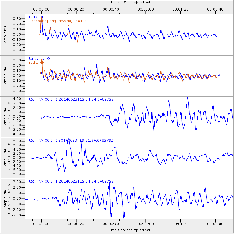
Signal To Noise
| Channel | StoN | STA | LTA |
| US:TPNV:00:BHZ:20140623T19:31:34.048979Z | 8.317933 | 7.9118075E-7 | 9.511747E-8 |
| US:TPNV:00:BH1:20140623T19:31:34.048979Z | 1.5133836 | 8.9933124E-8 | 5.9425204E-8 |
| US:TPNV:00:BH2:20140623T19:31:34.048979Z | 2.048274 | 2.2337971E-7 | 1.0905753E-7 |
| Arrivals |
| Ps | 1.9 SECOND |
| PpPs | 7.8 SECOND |
| PsPs/PpSs | 9.7 SECOND |


