You are here: Home > Network List > GS - US Geological Survey Networks Stations List
> Station DEC09 Decatur Surface Seismic Site, Decatur, IL, USA > Earthquake Result Viewer
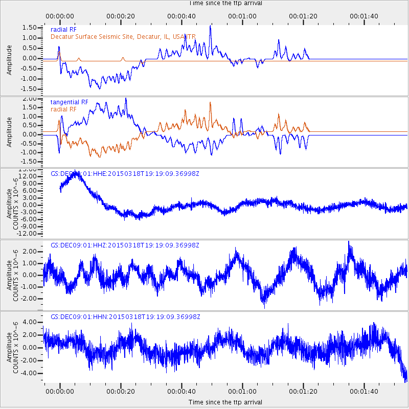
DEC09 Decatur Surface Seismic Site, Decatur, IL, USA - Earthquake Result Viewer
*The percent match for this event was below the threshold and hence no stack was calculated.
| Earthquake location: |
Near Coast Of Central Chile |
| Earthquake latitude/longitude: |
-36.1/-73.7 |
| Earthquake time(UTC): |
2015/03/18 (077) 19:07:48 GMT |
| Earthquake Depth: |
10 km |
| Earthquake Magnitude: |
5.4 MW, 5.2 mb, 5.1 MS |
| Earthquake Catalog/Contributor: |
ISC/ISC |
|
| Network: |
GS US Geological Survey Networks |
| Station: |
DEC09 Decatur Surface Seismic Site, Decatur, IL, USA |
| Lat/Lon: |
39.87 N/88.92 W |
| Elevation: |
207 m |
|
| Distance: |
76.9 deg |
| Az: |
348.038 deg |
| Baz: |
167.396 deg |
| Ray Param: |
$rayparam |
*The percent match for this event was below the threshold and hence was not used in the summary stack. |
|
| Radial Match: |
50.27678 % |
| Radial Bump: |
400 |
| Transverse Match: |
48.968903 % |
| Transverse Bump: |
400 |
| SOD ConfigId: |
7422571 |
| Insert Time: |
2019-04-17 20:07:22.665 +0000 |
| GWidth: |
2.5 |
| Max Bumps: |
400 |
| Tol: |
0.001 |
|
Signal To Noise
| Channel | StoN | STA | LTA |
| GS:DEC09:01:HHZ:20150318T19:19:09.36998Z | 1.4113704 | 7.799756E-7 | 5.5263706E-7 |
| GS:DEC09:01:HHN:20150318T19:19:09.36998Z | 0.9522015 | 2.8090137E-6 | 2.9500202E-6 |
| GS:DEC09:01:HHE:20150318T19:19:09.36998Z | 1.0234492 | 6.1822207E-6 | 6.0405737E-6 |
| Arrivals |
| Ps | |
| PpPs | |
| PsPs/PpSs | |


