WRAB Tennant Creek, NT, Australia - Earthquake Result Viewer
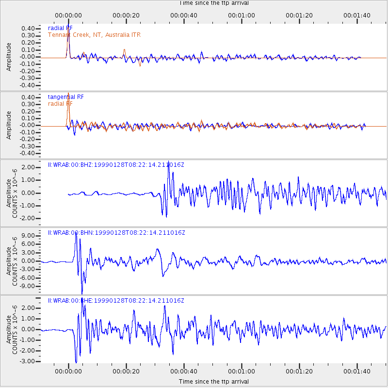
Earthquake location: Fox Islands, Aleutian Islands
Earthquake latitude/longitude: 52.9/-169.1
Earthquake time(UTC): 1999/01/28 (028) 08:10:05 GMT
Earthquake Depth: 67 km
Earthquake Magnitude: 6.3 MB, 6.1 MS, 6.6 MW, 6.6 ME
Earthquake Catalog/Contributor: WHDF/NEIC
Network: II Global Seismograph Network (GSN - IRIS/IDA)
Station: WRAB Tennant Creek, NT, Australia
Lat/Lon: 19.93 S/134.36 E
Elevation: 366 m
Distance: 87.4 deg
Az: 231.765 deg
Baz: 30.393 deg
Ray Param: 0.043211576
Estimated Moho Depth: 49.0 km
Estimated Crust Vp/Vs: 1.68
Assumed Crust Vp: 6.642 km/s
Estimated Crust Vs: 3.959 km/s
Estimated Crust Poisson's Ratio: 0.22
Radial Match: 97.54654 %
Radial Bump: 400
Transverse Match: 89.07023 %
Transverse Bump: 400
SOD ConfigId: 4480
Insert Time: 2010-03-01 23:21:39.257 +0000
GWidth: 2.5
Max Bumps: 400
Tol: 0.001

Signal To Noise

ChannelStoNSTALTA
II:WRAB:00:BHN:19990128T08:22:14.211016Z29.9311584.818944E-61.6100093E-7
II:WRAB:00:BHE:19990128T08:22:14.211016Z21.6272961.3937008E-66.444175E-8
II:WRAB:00:BHZ:19990128T08:22:14.211016Z13.255439.0543443E-76.8306676E-8
Arrivals
Ps5.1 SECOND
PpPs19 SECOND
PsPs/PpSs24 SECOND