You are here: Home > Network List > TA - USArray Transportable Network (new EarthScope stations) Stations List
> Station A21K Barrow, AK, USA > Earthquake Result Viewer
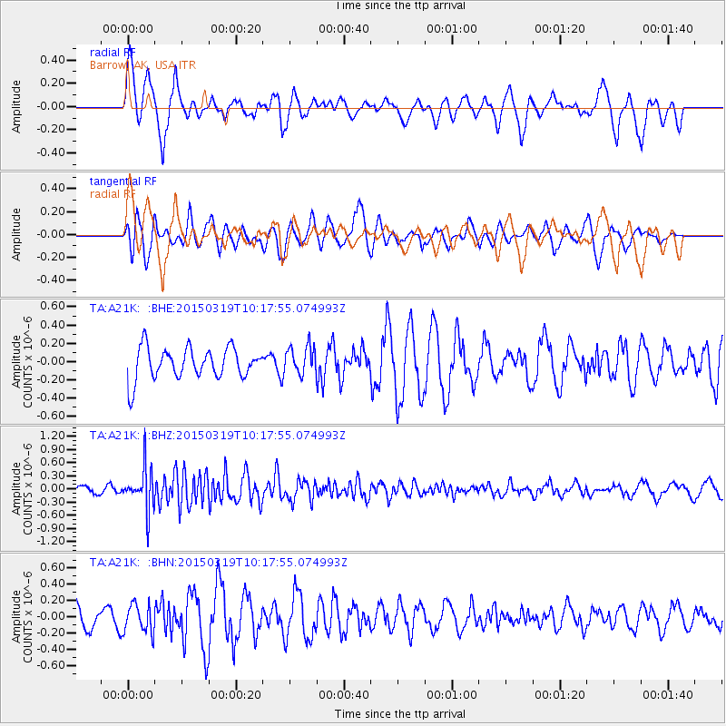
A21K Barrow, AK, USA - Earthquake Result Viewer
*The percent match for this event was below the threshold and hence no stack was calculated.
| Earthquake location: |
Northern Molucca Sea |
| Earthquake latitude/longitude: |
1.9/126.4 |
| Earthquake time(UTC): |
2015/03/19 (078) 10:06:01 GMT |
| Earthquake Depth: |
54 km |
| Earthquake Magnitude: |
5.2 MW, 4.3 MS, 5.3 mb |
| Earthquake Catalog/Contributor: |
ISC/ISC |
|
| Network: |
TA USArray Transportable Network (new EarthScope stations) |
| Station: |
A21K Barrow, AK, USA |
| Lat/Lon: |
71.32 N/156.62 W |
| Elevation: |
577 m |
|
| Distance: |
84.0 deg |
| Az: |
18.397 deg |
| Baz: |
258.244 deg |
| Ray Param: |
$rayparam |
*The percent match for this event was below the threshold and hence was not used in the summary stack. |
|
| Radial Match: |
63.728092 % |
| Radial Bump: |
400 |
| Transverse Match: |
57.55099 % |
| Transverse Bump: |
377 |
| SOD ConfigId: |
7422571 |
| Insert Time: |
2019-04-17 20:14:11.070 +0000 |
| GWidth: |
2.5 |
| Max Bumps: |
400 |
| Tol: |
0.001 |
|
Signal To Noise
| Channel | StoN | STA | LTA |
| TA:A21K: :BHZ:20150319T10:17:55.074993Z | 3.6526783 | 4.7134583E-7 | 1.2904117E-7 |
| TA:A21K: :BHN:20150319T10:17:55.074993Z | 0.9381752 | 1.7434874E-7 | 1.8583816E-7 |
| TA:A21K: :BHE:20150319T10:17:55.074993Z | 0.896568 | 1.5309256E-7 | 1.7075399E-7 |
| Arrivals |
| Ps | |
| PpPs | |
| PsPs/PpSs | |


