
WRAB Tennant Creek, NT, Australia - Earthquake Result Viewer
| ||||||||||||||||||
| ||||||||||||||||||
| ||||||||||||||||||
|
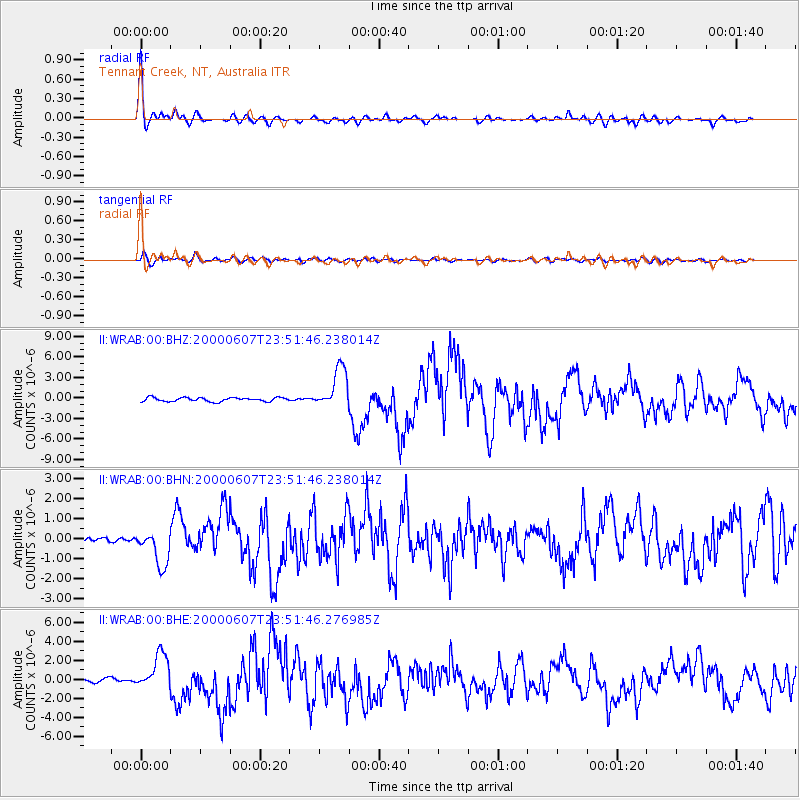
Signal To Noise
| Channel | StoN | STA | LTA |
| II:WRAB:00:BHN:20000607T23:51:46.238014Z | 4.6207857 | 8.813995E-7 | 1.9074668E-7 |
| II:WRAB:00:BHE:20000607T23:51:46.276985Z | 10.591178 | 1.8935453E-6 | 1.7878514E-7 |
| II:WRAB:00:BHZ:20000607T23:51:46.238014Z | 10.543474 | 2.9927187E-6 | 2.838456E-7 |
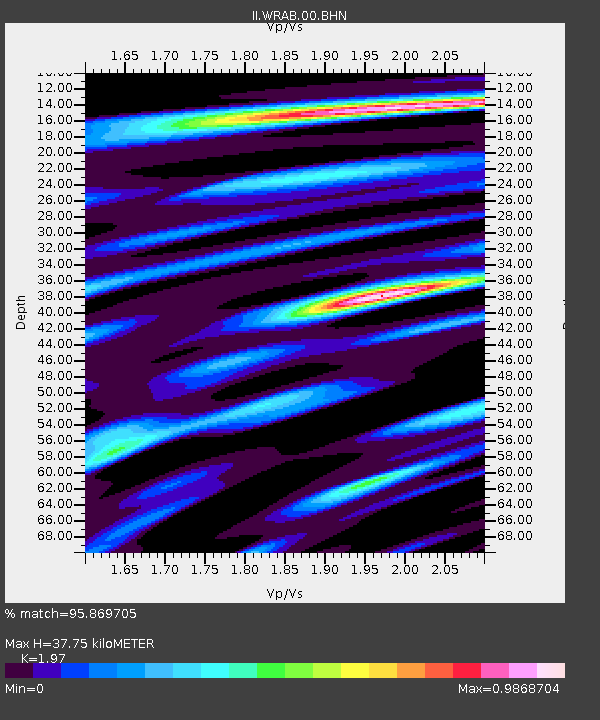
| Arrivals | |
| Ps | 5.9 SECOND |
| PpPs | 16 SECOND |
| PsPs/PpSs | 22 SECOND |

