You are here: Home > Network List > CN - Canadian National Seismograph Network Stations List
> Station INK INUVIK, NT > Earthquake Result Viewer
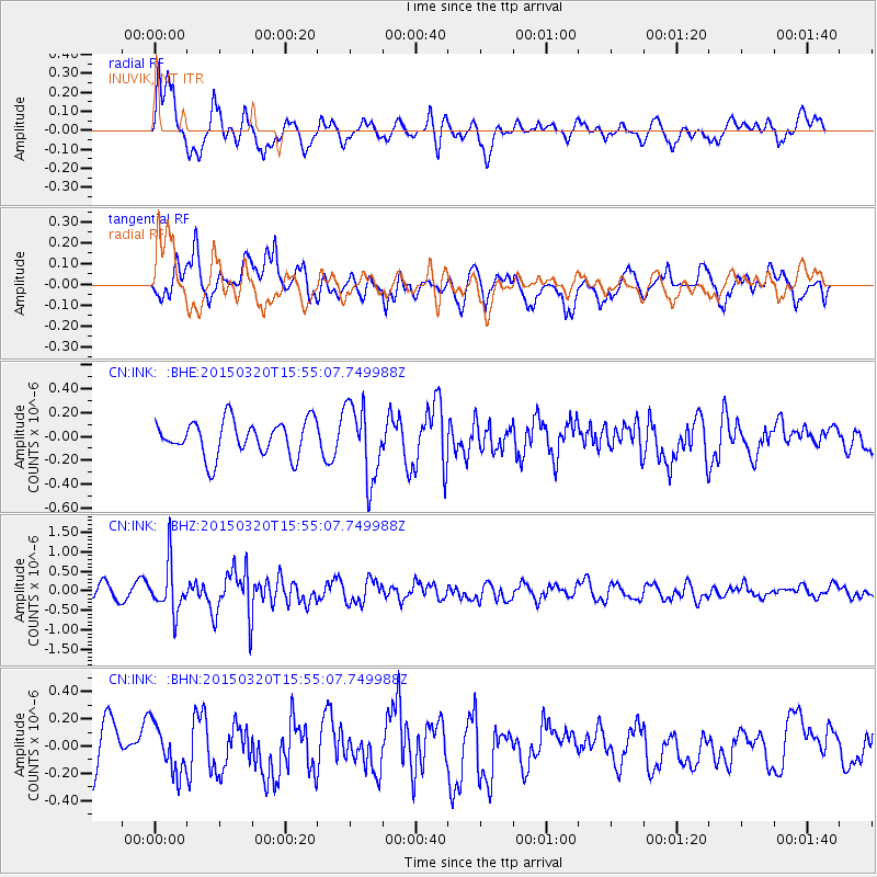
INK INUVIK, NT - Earthquake Result Viewer
*The percent match for this event was below the threshold and hence no stack was calculated.
| Earthquake location: |
Solomon Islands |
| Earthquake latitude/longitude: |
-4.8/154.8 |
| Earthquake time(UTC): |
2015/03/20 (079) 15:42:52 GMT |
| Earthquake Depth: |
26 km |
| Earthquake Magnitude: |
5.5 MWB |
| Earthquake Catalog/Contributor: |
NEIC PDE/NEIC COMCAT |
|
| Network: |
CN Canadian National Seismograph Network |
| Station: |
INK INUVIK, NT |
| Lat/Lon: |
68.31 N/133.53 W |
| Elevation: |
44 m |
|
| Distance: |
87.7 deg |
| Az: |
20.68 deg |
| Baz: |
251.19 deg |
| Ray Param: |
$rayparam |
*The percent match for this event was below the threshold and hence was not used in the summary stack. |
|
| Radial Match: |
74.86585 % |
| Radial Bump: |
400 |
| Transverse Match: |
62.88072 % |
| Transverse Bump: |
400 |
| SOD ConfigId: |
7422571 |
| Insert Time: |
2019-04-17 20:27:35.150 +0000 |
| GWidth: |
2.5 |
| Max Bumps: |
400 |
| Tol: |
0.001 |
|
Signal To Noise
| Channel | StoN | STA | LTA |
| CN:INK: :BHZ:20150320T15:55:07.749988Z | 3.3496487 | 6.276554E-7 | 1.8737947E-7 |
| CN:INK: :BHN:20150320T15:55:07.749988Z | 1.1670547 | 1.7559155E-7 | 1.5045701E-7 |
| CN:INK: :BHE:20150320T15:55:07.749988Z | 2.1504931 | 3.1582567E-7 | 1.4686198E-7 |
| Arrivals |
| Ps | |
| PpPs | |
| PsPs/PpSs | |


