You are here: Home > Network List > TA - USArray Transportable Network (new EarthScope stations) Stations List
> Station I23K Minto, Yukon-Koyukuk, AK, USA > Earthquake Result Viewer
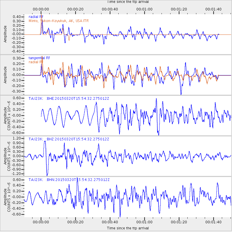
I23K Minto, Yukon-Koyukuk, AK, USA - Earthquake Result Viewer
*The percent match for this event was below the threshold and hence no stack was calculated.
| Earthquake location: |
Solomon Islands |
| Earthquake latitude/longitude: |
-4.8/154.8 |
| Earthquake time(UTC): |
2015/03/20 (079) 15:42:52 GMT |
| Earthquake Depth: |
26 km |
| Earthquake Magnitude: |
5.5 MWB |
| Earthquake Catalog/Contributor: |
NEIC PDE/NEIC COMCAT |
|
| Network: |
TA USArray Transportable Network (new EarthScope stations) |
| Station: |
I23K Minto, Yukon-Koyukuk, AK, USA |
| Lat/Lon: |
65.15 N/149.36 W |
| Elevation: |
149 m |
|
| Distance: |
80.7 deg |
| Az: |
20.745 deg |
| Baz: |
236.646 deg |
| Ray Param: |
$rayparam |
*The percent match for this event was below the threshold and hence was not used in the summary stack. |
|
| Radial Match: |
64.77254 % |
| Radial Bump: |
400 |
| Transverse Match: |
64.98666 % |
| Transverse Bump: |
400 |
| SOD ConfigId: |
7422571 |
| Insert Time: |
2019-04-17 20:29:30.925 +0000 |
| GWidth: |
2.5 |
| Max Bumps: |
400 |
| Tol: |
0.001 |
|
Signal To Noise
| Channel | StoN | STA | LTA |
| TA:I23K: :BHZ:20150320T15:54:32.275012Z | 7.0073013 | 6.596011E-7 | 9.413054E-8 |
| TA:I23K: :BHN:20150320T15:54:32.275012Z | 1.5651544 | 1.3912064E-7 | 8.888621E-8 |
| TA:I23K: :BHE:20150320T15:54:32.275012Z | 1.5743178 | 2.861062E-7 | 1.8173344E-7 |
| Arrivals |
| Ps | |
| PpPs | |
| PsPs/PpSs | |


