You are here: Home > Network List > TA - USArray Transportable Network (new EarthScope stations) Stations List
> Station O03E Paynes Creek, CA, USA > Earthquake Result Viewer
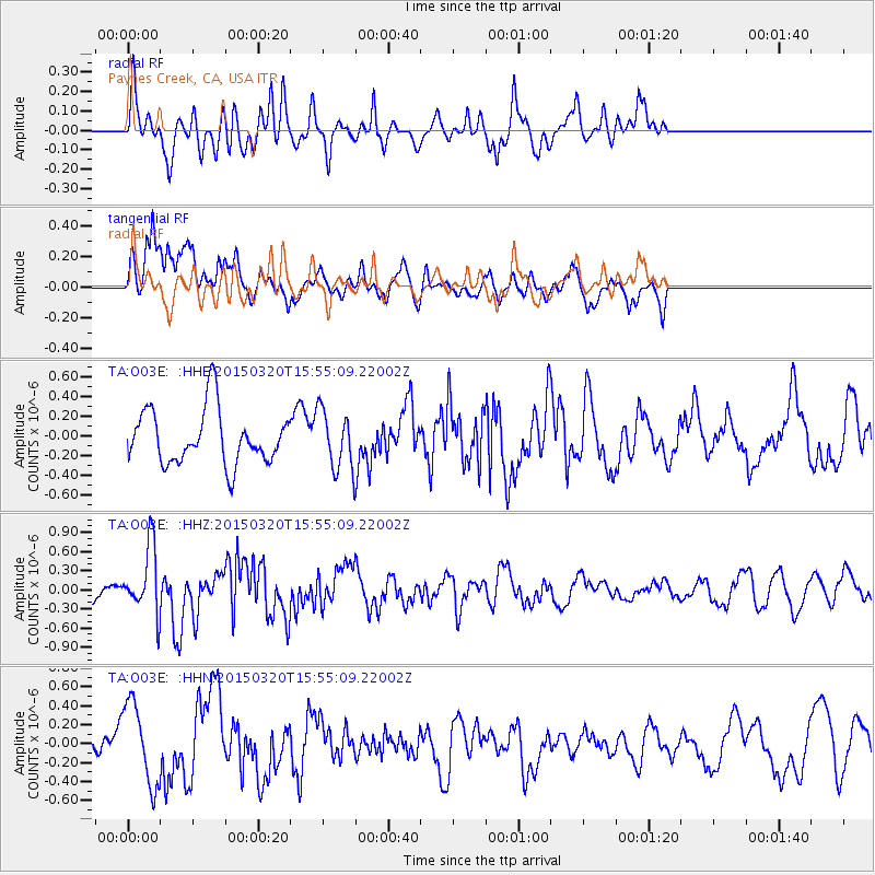
O03E Paynes Creek, CA, USA - Earthquake Result Viewer
*The percent match for this event was below the threshold and hence no stack was calculated.
| Earthquake location: |
Solomon Islands |
| Earthquake latitude/longitude: |
-4.8/154.8 |
| Earthquake time(UTC): |
2015/03/20 (079) 15:42:52 GMT |
| Earthquake Depth: |
26 km |
| Earthquake Magnitude: |
5.5 MWB |
| Earthquake Catalog/Contributor: |
NEIC PDE/NEIC COMCAT |
|
| Network: |
TA USArray Transportable Network (new EarthScope stations) |
| Station: |
O03E Paynes Creek, CA, USA |
| Lat/Lon: |
40.29 N/121.80 W |
| Elevation: |
967 m |
|
| Distance: |
88.0 deg |
| Az: |
49.482 deg |
| Baz: |
262.095 deg |
| Ray Param: |
$rayparam |
*The percent match for this event was below the threshold and hence was not used in the summary stack. |
|
| Radial Match: |
54.50472 % |
| Radial Bump: |
308 |
| Transverse Match: |
64.45978 % |
| Transverse Bump: |
400 |
| SOD ConfigId: |
7422571 |
| Insert Time: |
2019-04-17 20:29:35.837 +0000 |
| GWidth: |
2.5 |
| Max Bumps: |
400 |
| Tol: |
0.001 |
|
Signal To Noise
| Channel | StoN | STA | LTA |
| TA:O03E: :HHZ:20150320T15:55:09.22002Z | 3.1073644 | 5.18194E-7 | 1.6676319E-7 |
| TA:O03E: :HHN:20150320T15:55:09.22002Z | 2.4292023 | 4.3117325E-7 | 1.7749582E-7 |
| TA:O03E: :HHE:20150320T15:55:09.22002Z | 0.9929933 | 2.7473158E-7 | 2.7667014E-7 |
| Arrivals |
| Ps | |
| PpPs | |
| PsPs/PpSs | |


